NWS National Hurricane Center Miami FL
800 AM EDT Fri Oct 18 2024
For the North Atlantic...Caribbean Sea and the Gulf of Mexico:
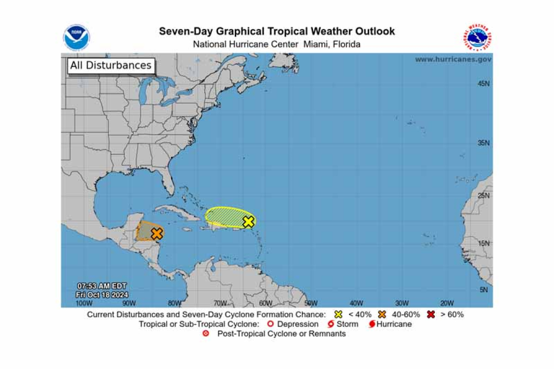
North of Puerto Rico and the Virgin Islands (AL94):
A trough of low pressure is producing disorganized showers and thunderstorms extending a couple hundred miles north of Puerto Rico and the Virgin Islands. Development, if any, of this disturbance should be slow to occur while it moves quickly westward to west-northwestward at around 20 mph, continuing north of Puerto Rico and the Virgin Islands today, then near Hispaniola and the southeast-ern Bahamas this weekend. Further development is not expected due to strong upper-level winds by early next week.
* Formation chance through 48 hours...low...10 percent.
* Formation chance through 7 days...low...10 percent.
Western Caribbean Sea (AL95):
 Widespread showers and thunderstorms continue across the northwestern Caribbean Sea in associa-tion with a broad area of low pressure that is gradually becoming better defined to the north of east-ern Honduras. Environmental conditions appear conducive for some additional development over the next day or so, and a short-lived tropical depression or storm could form before the system moves inland over Belize and the Yucatan Peninsula of Mexico on Saturday. Regardless of development, lo-cally heavy rainfall is likely across portions of Central America and southern Mexico through the weekend.
* Formation chance through 48 hours...medium...50 percent.
* Formation chance through 7 days...medium...50 percent.
Forecaster Hogsett/Cangialosi


