
...TROPICAL STORM WATCH ISSUED FOR BERMUDA...
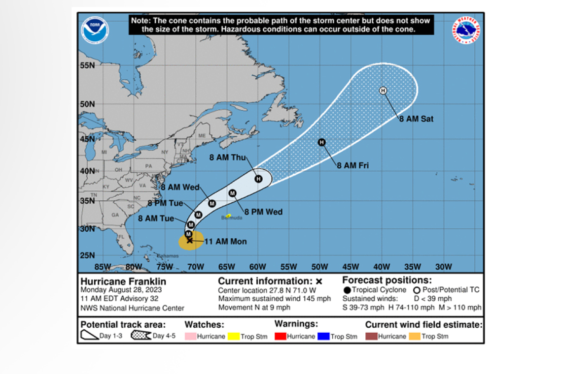
Hurricane Franklin Advisory Number 32
NWS National Hurricane Center Miami FL AL082023
1100 AM EDT Mon Aug 28 2023
SUMMARY OF 1100 AM EDT...1500 UTC...INFORMATION
-----------------------------------------------
LOCATION...27.8N 71.0W
ABOUT 440 MI...710 KM N OF GRAND TURK ISLAND
ABOUT 480 MI...770 KM SW OF BERMUDA
MAXIMUM SUSTAINED WINDS...145 MPH...230 KM/H
PRESENT MOVEMENT...N OR 350 DEGREES AT 9 MPH...15 KM/H
MINIMUM CENTRAL PRESSURE...937 MB...27.67 INCHES
WATCHES AND WARNINGS
--------------------
CHANGES WITH THIS ADVISORY:
The Meteorological Service of Bermuda has issued a Tropical Storm Watch for Bermuda.
SUMMARY OF WATCHES AND WARNINGS IN EFFECT:
A Tropical Storm Watch is in effect for...
* Bermuda
A Tropical Storm Watch means that tropical storm conditions are possible within the watch area, generally within 48 hours.
For storm information specific to your area, please monitor products issued by your national meteor-ological service.
DISCUSSION AND OUTLOOK
----------------------
 At 1100 AM EDT (1500 UTC), the center of Hurricane Franklin was located near latitude 27.8 North, longitude 71.0 West. Franklin is moving toward the north near 9 mph (15 km/h). This northward to north-northeastward motion with a slightly faster forward speed is expected during the next few days. On the forecast track, the center of Franklin is expected to pass well west of Bermuda on Wednesday.
Based on data from the Air Force Reserve Hurricane Hunter aircraft, maximum sustained winds have increased to near 145 mph (230 km/h) with higher gusts. Franklin is a category 4 hurricane on the Saf-fir-Simpson Hurricane Wind Scale. Additional strengthening is possible today, but gradual weakening
is expected to begin later Tuesday.
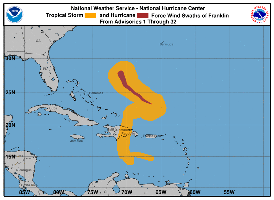
Hurricane-force winds extend outward up to 35 miles (55 km) from the center and tropi-cal-storm-force winds extend outward up to 150 miles (240 km).
The estimated minimum central pressure is 937 mb based on data from aircraft reconnaissance (27.67 inches).
HAZARDS AFFECTING LAND
----------------------
SURF: Swells, life-threatening surf and rip currents generated by Franklin are beginning to affect Ber-muda and the Southeast United States and are expected to spread northward along the east coast of the United States and Atlantic Canada during the next couple of days.
WIND: Tropical storm conditions are possible within the watch area by Wednesday morning.
Forecaster Kelly/Brown


