
NWS National Hurricane Center Miami FL
800 AM EDT Thu Aug 25 2022
For the North Atlantic...Caribbean Sea and the Gulf of Mexico:
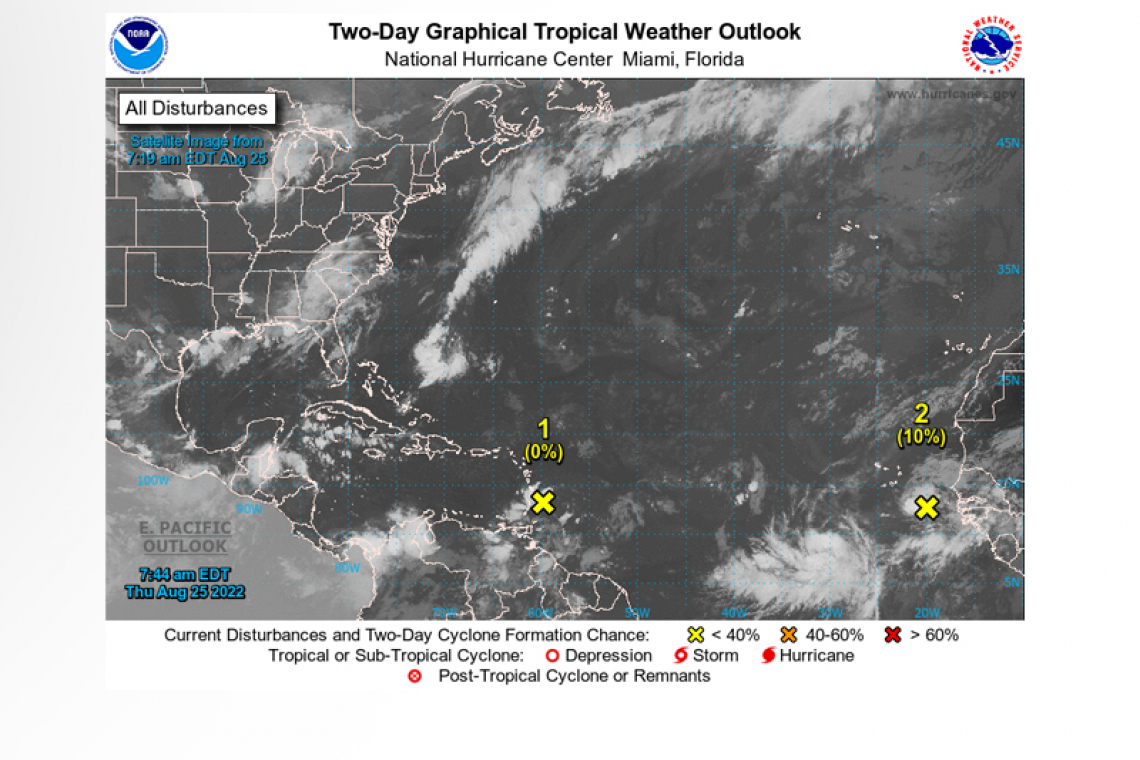
1. Near the Windward Islands:
A well-defined tropical wave is moving across the Windward Islands while producing disorganized shower and thunderstorm activity. This system is expected to move westward at about 15 mph during the next several days, and environmental conditions could become more conducive for slow development when it moves across the central and western Caribbean Sea early next week.
* Formation chance through 48 hours...low...near 0 percent.
* Formation chance through 5 days...low...20 percent.
2. Eastern Tropical Atlantic:
 A tropical wave has moved off the west coast of Africa and is producing a large area of disorganized showers and thunderstorms.
Environmental conditions could support some slow development of this system through early next week while it moves quickly westward across the eastern and central tropical Atlantic at 15 to 20 mph.
* Formation chance through 48 hours...low...10 percent.
* Formation chance through 5 days...low...20 percent.
Forecaster Berg


