
NWS National Hurricane Center Miami FL
800 AM EDT Mon Jun 19 2023
For the North Atlantic...Caribbean Sea and the Gulf of Mexico:
Central Tropical Atlantic:
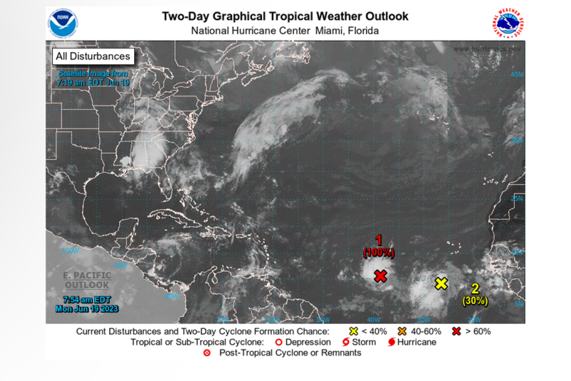
Satellite images indicate that the area of low pressure located roughly midway between Africa and the Lesser Antilles has become better organized overnight and is close to becoming a tropical cyclone. If current trends continue, advisories could be initiated on a tropical depression later today.
This sys-tem is forecast to move generally westward at 15 to 20 mph with further development across the central tropical Atlantic through the middle part of this week.
* Formation chance through 48 hours...high...near 100 percent.
* Formation chance through 7 days...high...near 100 percent.
Eastern Tropical Atlantic:
 Showers and thunderstorms have increased in association with a tropical wave located several hun-dred miles south-southwest of the Cabo Verde Islands. Further development of this system is possible, and a tropical depression could form within the next few days while the system moves westward at 10 to 15 mph across the eastern and central tropical Atlantic.
* Formation chance through 48 hours...low...30 percent.
* Formation chance through 7 days...medium...40 percent


