NWS National Hurricane Center Miami FL
800 AM EDT Mon Jul 31 2023
For the North Atlantic...Caribbean Sea and the Gulf of Mexico:
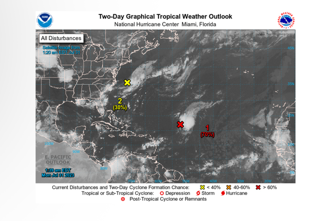
Central Tropical Atlantic:
Shower and thunderstorm activity continues in association with an area of low pressure located about 700 miles east-northeast of the northern Leeward Islands. However, the system does not currently have a well-defined center of circulation. Environmental conditions are forecast to be sufficiently fa-vorable for development over the next few days, and a tropical depression or storm is likely to form during the next day or so. The system is expected to move northwestward at 10 to 15 mph today, and then turn northward over the central subtropical Atlantic by late tonight or Tuesday.
* Formation chance through 48 hours...high...70 percent.
* Formation chance through 7 days...high...80 percent.
Off the U.S. Mid-Atlantic Coast:
 Shower and thunderstorm activity has changed little in association with an area of low pressure lo-cated offshore of the U.S. Mid-Atlantic coast. The system appears to be acquiring non-tropical char-acteristics as it begins to merge with a frontal boundary, and its chances of becoming a tropical cy-clone appear to be decreasing. Regardless, the low is expected to begin producing gale-force winds today while it moves quickly toward the east-northeast at about 30 mph, and additional information on this system can be found in High Seas Forecasts issued by the National Weather Service.
* Formation chance through 48 hours...low...20 percent.
* Formation chance through 7 days...low...20 percent.
Forecaster Berg


