NWS National Hurricane Center Miami FL
800 AM EDT Tue Sep 5 2023
For the North Atlantic...Caribbean Sea and the Gulf of Mexico:
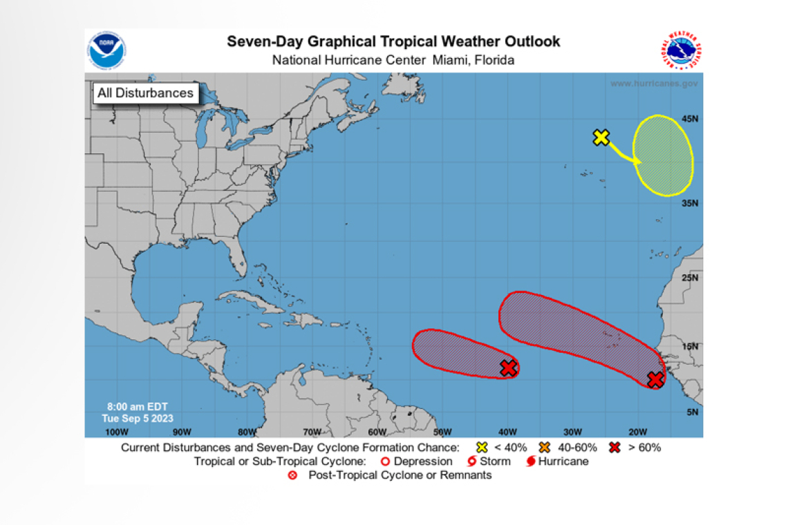
Central Tropical Atlantic (AL95):
Satellite images indicate that the area of low pressure located about midway between western Africa and the Windward Islands has become better organized overnight. If current trends continue, adviso-ries would be issued later today on a tropical cyclone moving west-northwest at 15 to 20 mph across the central tropical Atlantic. Additional strengthening to a hurricane is likely later this week while the system moves over western portions of the tropical Atlantic, near or to the northeast of the northern Leeward Islands.
* Formation chance through 48 hours...high...near 100 percent.
* Formation chance through 7 days...high...near 100 percent.
Eastern Tropical Atlantic:
 A strong tropical wave is near the coast of West Africa, producing a large area of cloudiness and showers. Environmental conditions appear conducive for gradual development, and a tropical depres-sion could form over the far eastern tropical Atlantic during the middle to latter part of the week while the system moves west-northwest at 10 to 15 mph. This system is expected to move across the Cabo Verde Islands Wednesday night and Thursday, and interests there should monitor its progress.
* Formation chance through 48 hours...low...30 percent.
* Formation chance through 7 days...high...70 percent.
Northeastern Atlantic (ex-Franklin):
Post-Tropical Cyclone Franklin is located a few hundred miles north of the Azores, and is forecast to move quickly southeastward towards warmer waters east of the Azores. This system could acquire some subtropical or tropical characteristics later this week or this weekend while it moves erratically between the Azores and Portugal.
* Formation chance through 48 hours...low...near 0 percent.
* Formation chance through 7 days...low...20 percent.
Forecaster Blake/Stevenson


