Tropical Storm Colin Advisory Number 2
NWS National Hurricane Center Miami FL AL032022
1100 AM EDT Sat Jul 02 2022

SUMMARY OF 1100 AM EDT...1500 UTC...INFORMATION
-----------------------------------------------
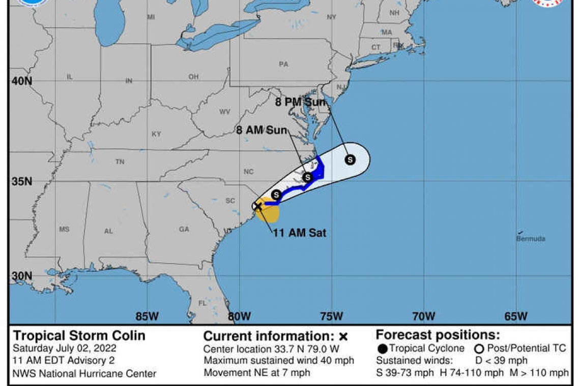
LOCATION...33.7N 79.0W
ABOUT 5 MI...10 KM W OF MYRTLE BEACH SOUTH CAROLINA
MAXIMUM SUSTAINED WINDS...40 MPH...65 KM/H
PRESENT MOVEMENT...NE OR 40 DEGREES AT 7 MPH...11 KM/H
MINIMUM CENTRAL PRESSURE...1012 MB...29.89 INCHES
WATCHES AND WARNINGS
--------------------
CHANGES WITH THIS ADVISORY:
None.
SUMMARY OF WATCHES AND WARNINGS IN EFFECT:
A Tropical Storm Warning is in effect for...
* South Santee River, South Carolina, to Duck, North Carolina
* Pamlico Sound
A Tropical Storm Warning means that tropical storm conditions are expected somewhere within the warning area within 36 hours.
For storm information specific to your area, including possible inland watches and warnings, please monitor products issued by your local National Weather Service forecast office.
DISCUSSION AND OUTLOOK
----------------------
At 1100 AM EDT (1500 UTC), the center of Tropical Storm Colin was located near latitude 33.7 North, longitude 79.0 West. Colin is moving toward the northeast near 7 mph (11 km/h). A slightly faster northeast to east-northeast motion is expected during the next day or two. On the forecast track, the center of Colin is expected to move northeastward along or just inland of the South Carolina and North Carolina coasts through Sunday morning, and then emerge over the western Atlantic Ocean late Sunday.
Maximum sustained winds remain near 40 mph (65 km/h) with higher gusts. Little change in strength is forecast during the next day or so, but Colin is expected to dissipate by early Monday.
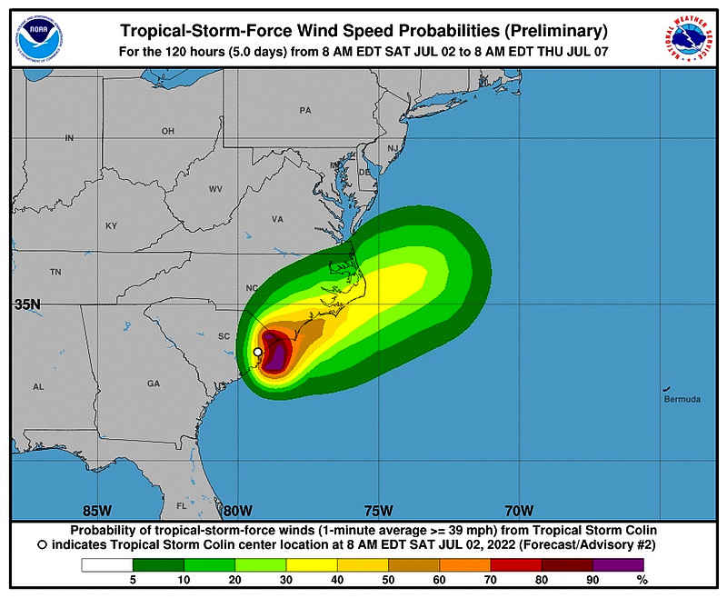
Tropical-storm-force winds extend outward up to 80 miles (130 km) mainly southeast of the center.
The estimated minimum central pressure is 1012 mb (29.89 inches).
HAZARDS AFFECTING LAND
----------------------
WIND: Tropical storm conditions are expected within the warning area in North Carolina this afternoon through Sunday.
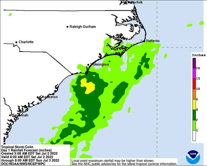
RAINFALL: Colin will continue to produce locally heavy rainfall across portions of coastal South and North Carolina through Sunday morning. An additional 1 to 2 inches of rainfall, with isolated amounts up to 4 inches in eastern North Carolina, are possible. This rainfall may result in localized areas of flash flooding.
SURF: Swells generated by Colin are affecting portions of the coast of the Carolina coast. These swells could cause life-threatening surf and rip current conditions. Please consult products from your local weather office.
Forecaster Cangialosi


