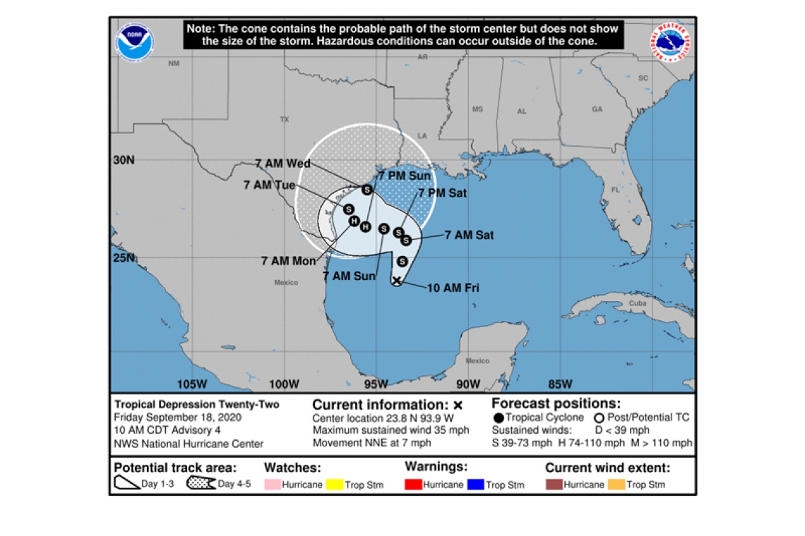
Tropical Depression Twenty-Two Advisory Number 4
NWS National Hurricane Center Miami FL AL222020
1000 AM CDT Fri Sep 18 2020
SUMMARY OF 1000 AM CDT...1500 UTC...INFORMATION
-----------------------------------------------
LOCATION...23.8N 93.9W
ABOUT 275 MI...445 KM ENE OF TAMPICO MEXICO
ABOUT 255 MI...405 KM SE OF MOUTH OF THE RIO GRANDE
MAXIMUM SUSTAINED WINDS...35 MPH...55 KM/H
PRESENT MOVEMENT...NNE OR 15 DEGREES AT 7 MPH...11 KM/H
MINIMUM CENTRAL PRESSURE...1005 MB...29.68 INCHES
WATCHES AND WARNINGS
--------------------
Interests along the western Gulf of Mexico coast should monitor the progress of the depression.
DISCUSSION AND OUTLOOK
----------------------
 At 1000 AM CDT (1500 UTC), the center of Tropical Depression Twenty-Two was located near latitude 23.8 North, longitude 93.9 West. The depression is moving toward the north-northeast near 7 mph (11 km/h), and this general motion is expected through early Saturday. A slow westward motion is forecast to begin late Saturday or Saturday night, and this motion will likely continue into early next week.
Maximum sustained winds are near 35 mph (55 km/h) with higher gusts. Strengthening is forecast during the next few days, and the depression is expected to become a tropical storm later today. The system could be near or at hurricane strength by Sunday.
The estimated minimum central pressure is 1005 mb (29.68 inches).
HAZARDS AFFECTING LAND
----------------------
SURF: Swells are expected to increase and reach the coast of Texas and the Gulf Coast of Mexico over the weekend, generated by a combination of the depression and a cold front entering the northern Gulf of Mexico. These swells are likely to cause life-threatening surf and rip current conditions. Pease consult products from your local weather office.
Forecaster Beven


