Meteorological Department St. Maarten
DATE ISSUED: Sunday, 04 September, 2022 TIME: 5:30 AM (09:30 UTC)
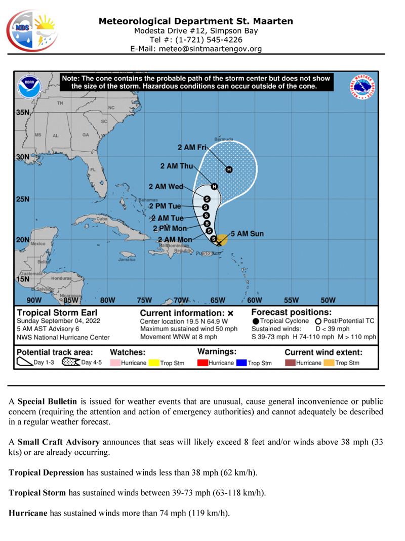
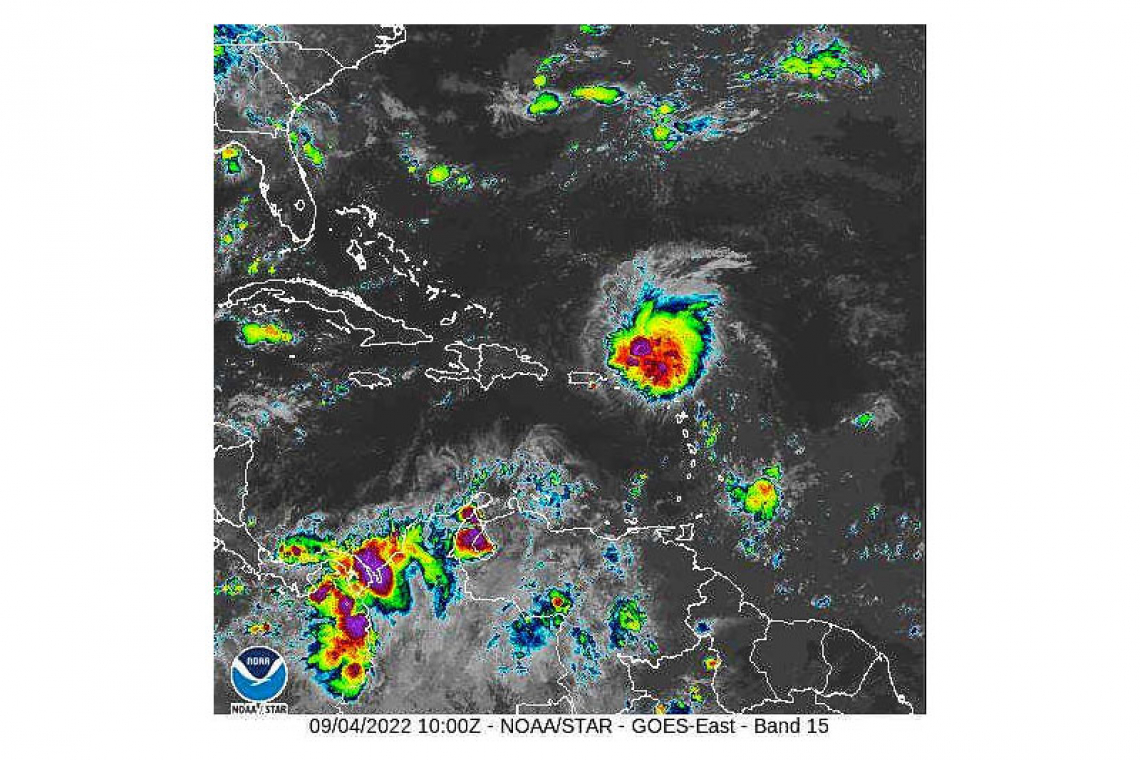
At 5:00 am (0900 UTC), the center of Tropical Storm Earl was about 155 miles north northwest of St. Maarten. Earl continues to move toward the west-northwest near 8 mph (13 km/h). A slower and gradual turn toward the northwest and then north is expected from tonight through Tuesday. This system is moving further away from St. Maarten. Maximum sustained winds remain near 50 mph (85 km/h) with higher gusts. Tropical storm force winds extend outward up to 105 miles (165 km) from the center.
POTENTIAL IMPACTS FOR ST. MAARTEN:
Rainfall: Tropical Storm Earl is expected to produce total rainfall accumulations of 1 inch.
Flooding and/or rockslides are possible in flood-prone areas and along hillsides. Residents and users of these areas are advised to exercise caution and be vigilant.
Winds: Gusty winds up to 30 mph could accompany heavy showers and thunderstorms.
Residents and visitors are urged to remain vigilant, use caution outdoors, and monitor all subsequent updates.
FORECASTER: Gordon
This is the final bulletin on Tropical Storm Earl.
SPECIAL WEATHER BULLETIN


