NWS National Hurricane Center Miami FL
800 AM EDT Wed Aug 4 2021
For the North Atlantic...Caribbean Sea and the Gulf of Mexico:
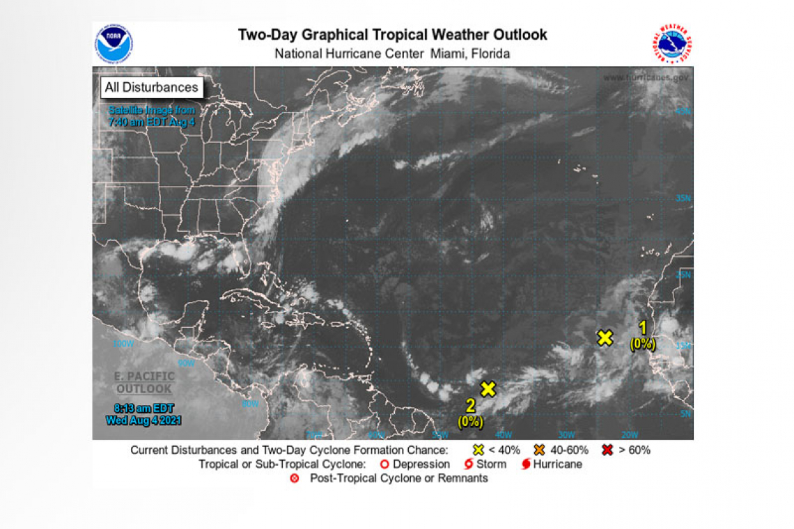
A small and weak area of low pressure, with limited shower and thunderstorm activity, is passing near the Cabo Verde Islands. Significant development of this system is not expected during the next day or so due to u environmental conditions. Thereafter, this system is forecast to move northward or north-northwest over cooler waters, ending its development chances. Locally heavy rainfall and gusty winds are possible over portions of the Cabo Verde Islands through today.
* Formation chance through 48 hours...low...near 0 percent.
* Formation chance through 5 days...low...near 0 percent.
A tropical wave is forecast to move off the west coast of Africa by late Thursday. Environmental conditions appear somewhat conducive for some slow development over the far eastern Atlantic through the weekend into early next week while the system moves generally westward at about 15 mph.
* Formation chance through 48 hours...low...near 0 percent.
* Formation chance through 5 days...low...30 percent.

A tropical wave located over the central tropical Atlantic is producing a broad area of disorganized showers and thunderstorms. Environmental conditions are expected to be marginally conducive for some slow development east of the Lesser Antilles by Sunday and into early next week while the disturbance moves west-northwest at 10 to 15 mph.
* Formation chance through 48 hours...low...near 0 percent.
* Formation chance through 5 days...low...20 percent.
Forecaster Stewart


