NWS National Hurricane Center Miami FL
800 AM EDT Sat Aug 29 2020
For the North Atlantic...Caribbean Sea and the Gulf of Mexico:

The Weather Prediction Center has issued its last advisory on
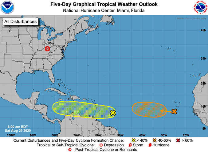
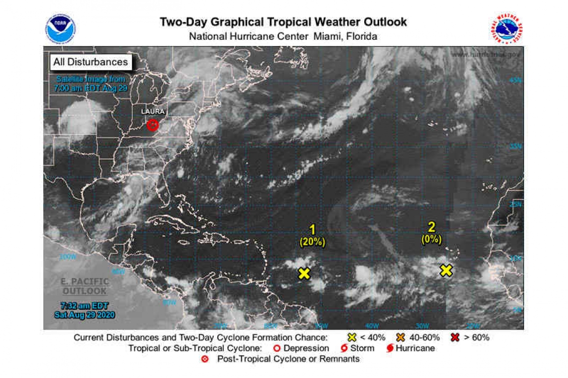
Post-Tropical Cyclone Laura, located inland over northeastern
Kentucky.
- A tropical wave located about 550 miles east of the Windward Islands is producing disorganized showers and thunderstorms. Some gradual development of this system is possible during the next several days while it moves westward at about 15 mph toward the Lesser Antilles. Regardless of development, this system will likely produce gusty winds and locally heavy rainfall across portions of the Windward and Leeward Islands on Sunday.
* Formation chance through 48 hours...low...20 percent.
* Formation chance through 5 days...low...30 percent.
- Another tropical wave is located over the eastern Atlantic Ocean just southwest of the Cabo Verde Islands. This system is expected to move very slowly for the next several days, and some development is possible early next week over the eastern or central tropical Atlantic.
* Formation chance through 48 hours...low...near 0 percent.
* Formation chance through 5 days...medium...40 percent.
Forecaster Beven


