NWS National Hurricane Center Miami FL
For the North Atlantic...Caribbean Sea and the Gulf of Mexico:
Active Systems:
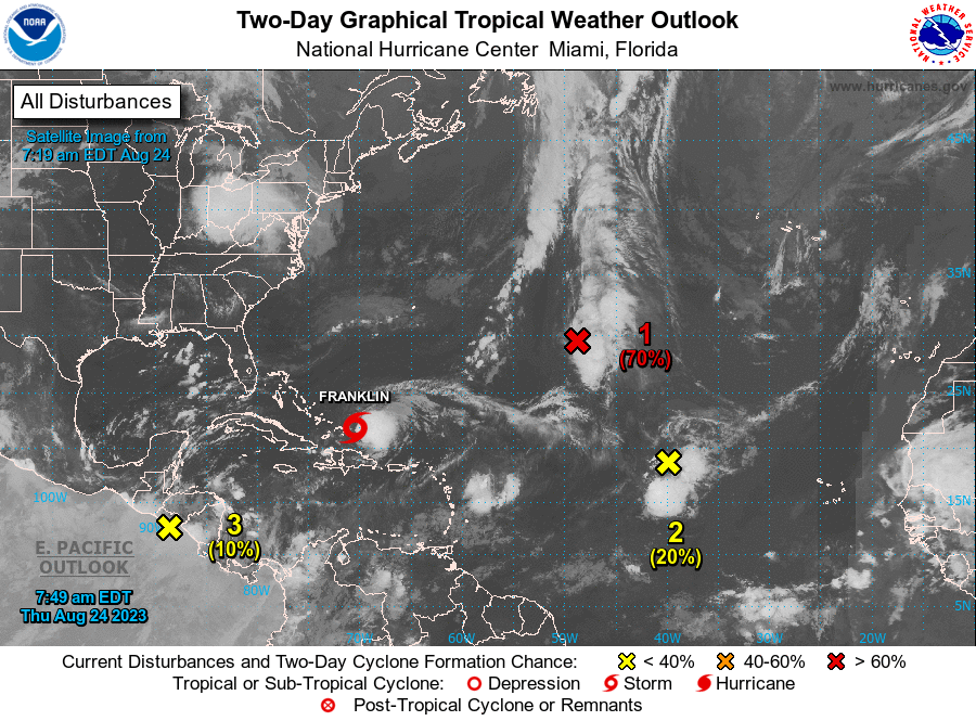
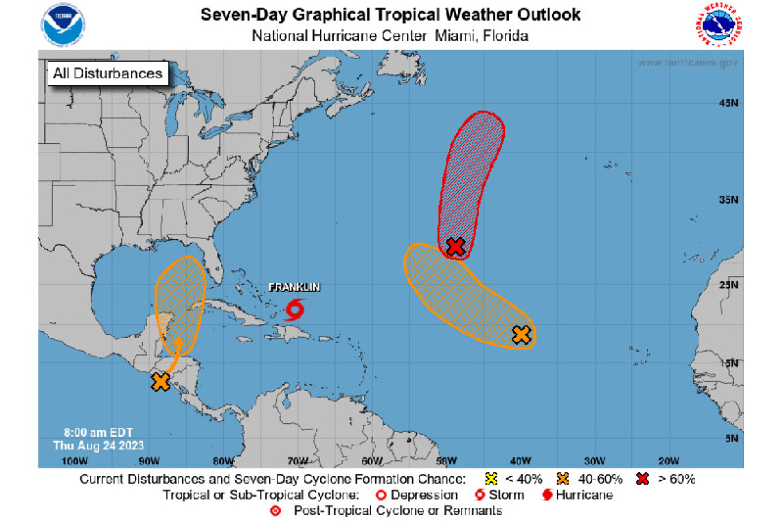
The National Hurricane Center is issuing advisories on Tropical Storm Franklin, located to the east of the Turks and Caicos Islands.
Central Subtropical Atlantic (Remnants of Emily):
An area of low pressure located more than 1000 miles east-southeast of Bermuda (the remnants of former Tropical Storm Emily) continues to produce a large but elongated area of disorganized showers and thunderstorms. Upper-level winds are generally conducive for development today, and this system is likely to regenerate into a tropical storm over the next couple of days as the system moves northward over the subtropical central Atlantic. By this weekend, the system is anticipated to merge with a frontal boundary north of the Gulf Stream. .
* Formation chance through 48 hours...high...70 percent.
* Formation chance through 7 days...high...70 percent.
Eastern Tropical Atlantic (AL92):
Disorganized showers and thunderstorms continue in association with an area of low pressure located several hundred miles west of the Cabo Verde Islands. Despite marginal environmental conditions, slow development is possible and a tropical depression could form by early next week while the system moves west-northwestward to northwestward into the central subtropical Atlantic.
* Formation chance through 48 hours...low...20 percent.
* Formation chance through 7 days...medium...40 percent.
Northwestern Caribbean Sea:
A broad area of low pressure, originating along the East Pacific coast of Central America, is forecast to move into northwestern Caribbean Sea by this weekend. Some gradual development of this system is possible thereafter into early next week, and a tropical depression could form while it moves slowly northward, entering the eastern Gulf of Mexico.
* Formation chance through 48 hours...low...10 percent.
* Formation chance through 7 days...medium...50 percent.

Forecaster Papin


