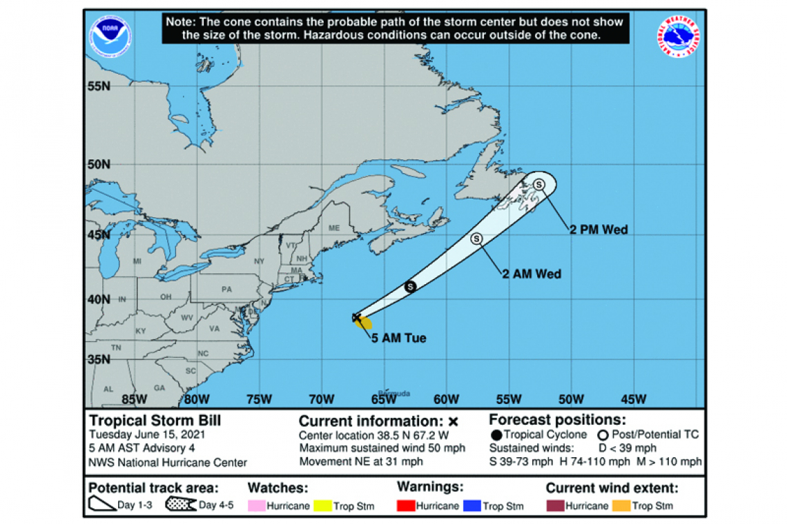
...EXPECTED TO BE A SHORT-LIVED TROPICAL STORM...
Tropical Storm Bill Advisory Number 4
NWS National Hurricane Center Miami FL AL022021
500 AM AST Tue Jun 15 2021
SUMMARY OF 500 AM AST...0900 UTC...INFORMATION
----------------------------------------------
LOCATION...38.5N 67.2W
ABOUT 240 MI...385 KM SE OF NANTUCKET MASSACHUSETTS
ABOUT 460 MI...740 KM SSW OF HALIFAX NOVA SCOTIA
MAXIMUM SUSTAINED WINDS...50 MPH...85 KM/H
PRESENT MOVEMENT...NE OR 50 DEGREES AT 31 MPH...50 KM/H
MINIMUM CENTRAL PRESSURE...999 MB...29.50 INCHES
WATCHES AND WARNINGS
--------------------
There are no coastal watches or warnings in effect.
DISCUSSION AND OUTLOOK
----------------------
At 500 AM AST (0900 UTC), the center of Tropical Storm Bill was located near latitude 38.5 North, longitude 67.2 West. Bill is moving rapidly toward the northeast near 31 mph (50 km/h), and this general motion is expected to continue through Wednesday.
Maximum sustained winds have increased to near 50 mph (85 km/h) with higher gusts. Little change in strength is expected today, followed by gradual weakening tonight and Wednesday morning when Bill will be moving over colder water. The system is forecast to become a post-tropical low by tonight and dissipate on Wednesday.
Tropical-storm-force winds extend outward up to 90 miles (150 km) from the center.
The estimated minimum central pressure is 999 mb (29.50 inches).
HAZARDS AFFECTING LAND
----------------------
None.


