PUBLIC WEATHER FORECAST FOR ST. MAARTEN
DATE ISSUED: Friday, September 18, 2020 @ 12:00 LST (16:00 UTC)
VALID UNTIL: Saturday midday (12:00 LST) September 19, 2020
...SMALL CRAFT AND HIGH SURF ADVISORIES ARE IN EFFECT FOR
ST. MAARTEN UNTIL FURTHER NOTICE…
WEATHER:
This afternoon through Saturday midday: Partly cloudy with light haze and localized showers.
Forecast High: 32°C / 90°F Forecast Low: 28°C / 82°F
Sunset Today: 6:12 P.M. Sunrise Tomorrow: 6:01 A.M.
SURFACE WINDS:
This afternoon through Saturday midday: Northerly to northeasterly with a light to gentle breeze of 04 to 10 mph, becoming variable and lighter at times.
SYNOPSIS:
Low level moisture transported across the local area by light winds and daytime heating will account for localized showers.
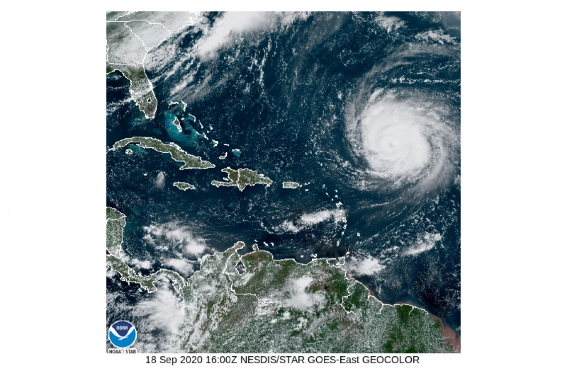
Large swells generated by Hurricane Teddy will continue to create hazardous sea conditions for the next few days. Small craft operators and seas bathers should continue exercising extreme caution.

STATE OF THE SEA: Moderate to rough WAVES/SWELLS: 6 to 10 feet
SPECIAL FEATURES:
As of 11:00 am the center of Hurricane Teddy was located about 530 miles east northeast of St. Maarten. Based on its projected path Teddy does not pose a direct threat to the island.
At 11am, Tropical Storm Wilfred was formed and is located about 2090 miles southeast of St. Maarten.
Maximum sustained winds are near 40 mph with higher gusts. Some slight strengthening is possible today, and weakening should start this weekend and continue into next week. This system is not expected to impact land.
THE METEOROLOGICAL DEPARTMENT OF ST. MAARTEN WILL CONTINUE TO MONITOR THESE SYSTEMS AND UPDATE THE PUBLIC ACCORDINGLY.
OUTLOOK through Sunday midday: Partly cloudy with isolated showers possible.
FORECASTER: Gordon


