Tropical Storm Pamela Advisory Number 14
NWS National Hurricane Center Miami FL EP162021
900 AM MDT Wed Oct 13 2021
SUMMARY OF 900 AM MDT...1500 UTC...INFORMATION
----------------------------------------------

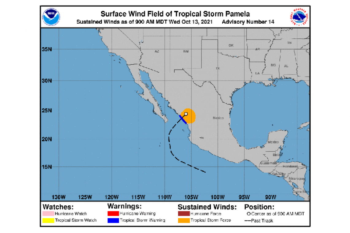
LOCATION...24.4N 106.0W
ABOUT 85 MI...140 KM NNE OF MAZATLAN MEXICO
MAXIMUM SUSTAINED WINDS...65 MPH...100 KM/H
PRESENT MOVEMENT...NE OR 45 DEGREES AT 23 MPH...37 KM/H
MINIMUM CENTRAL PRESSURE...992 MB...29.30 INCHES
WATCHES AND WARNINGS
--------------------
CHANGES WITH THIS ADVISORY:
The government of Mexico has changed the Hurricane Warning to a Tropical Storm Warning from Bahia Tempehuaya to Escuinapa.
All other Tropical Storm Warnings have been discontinued.
SUMMARY OF WATCHES AND WARNINGS IN EFFECT:
A Tropical Storm Warning is in effect for...
* Bahia Tempehuaya to Escuinapa
A Tropical Storm Warning means that tropical storm conditions are occurring within the warning area now.
For storm information specific to your area, please monitor products issued by your national meteorological service.
DISCUSSION AND OUTLOOK
----------------------
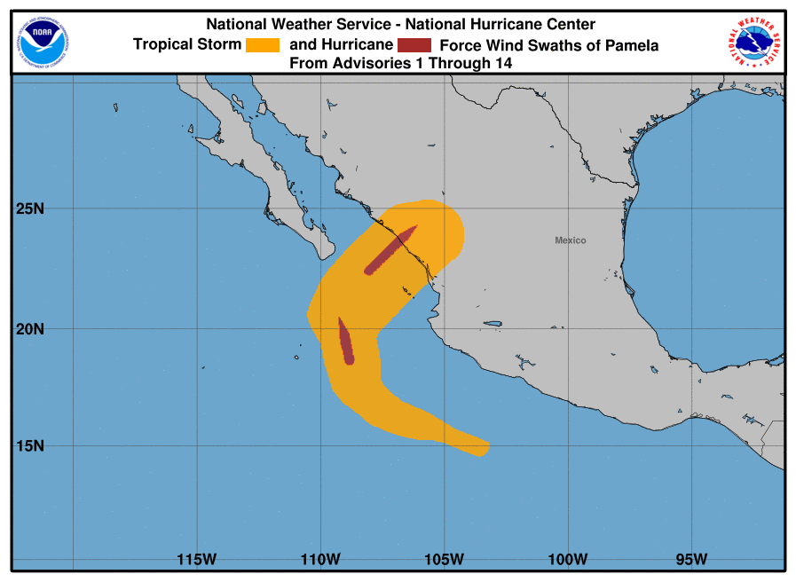
At 900 AM MDT (1500 UTC), the center of Tropical Storm Pamela was located near latitude 24.4 North, longitude 106.0 West. Pamela is accelerating toward the northeast near 23 mph (37 km/h) and this motion is expected to continue at a faster speed prior to dissipation.
Maximum sustained winds are near 65 mph (100 km/h) with higher gusts. Additional rapid weakening is forecast as the center moves farther inland.
Tropical-storm-force winds extend outward up to 140 miles (220 km) from the center.
The estimated minimum central pressure is 992 mb (29.30 inches).
HAZARDS AFFECTING LAND
----------------------
STORM SURGE: Storm surge is expected to produce significant coastal flooding in areas of onshore winds within the warning area. Near the coast, the surge will be accompanied by large and destructive waves.
WIND: Tropical Storm conditions are occuring within the Tropical Storm Warning area for the next few hours but should end later this afternoon.
RAINFALL: Through Thursday, Pamela or its remnants are expected to produce the following rainfall amounts:
Across the Mexican States of Sinaloa, western Durango, and northern Nayarit...4 to 8 inches with isolated maximum totals of 12 inches. This rainfall may trigger significant and life-threatening flash flooding and mudslides.
Across portions of central Texas and southeastern Oklahoma...3 to 6 inches with isolated maximum totals of 8 inches. This may result in considerable flash and urban flooding impacts.
SURF: Swells generated by Pamela will continue to affect portions of the southern Baja California peninsula, as well as southwestern and west-central mainland Mexico through today. These swells are likely to cause life-threatening surf and rip current conditions. Please consult products from your local weather office.
Forecaster Papin


