NWS National Hurricane Center Miami FL
800 AM EDT Wed Sep 18 2024
For the North Atlantic...Caribbean Sea and the Gulf of Mexico:
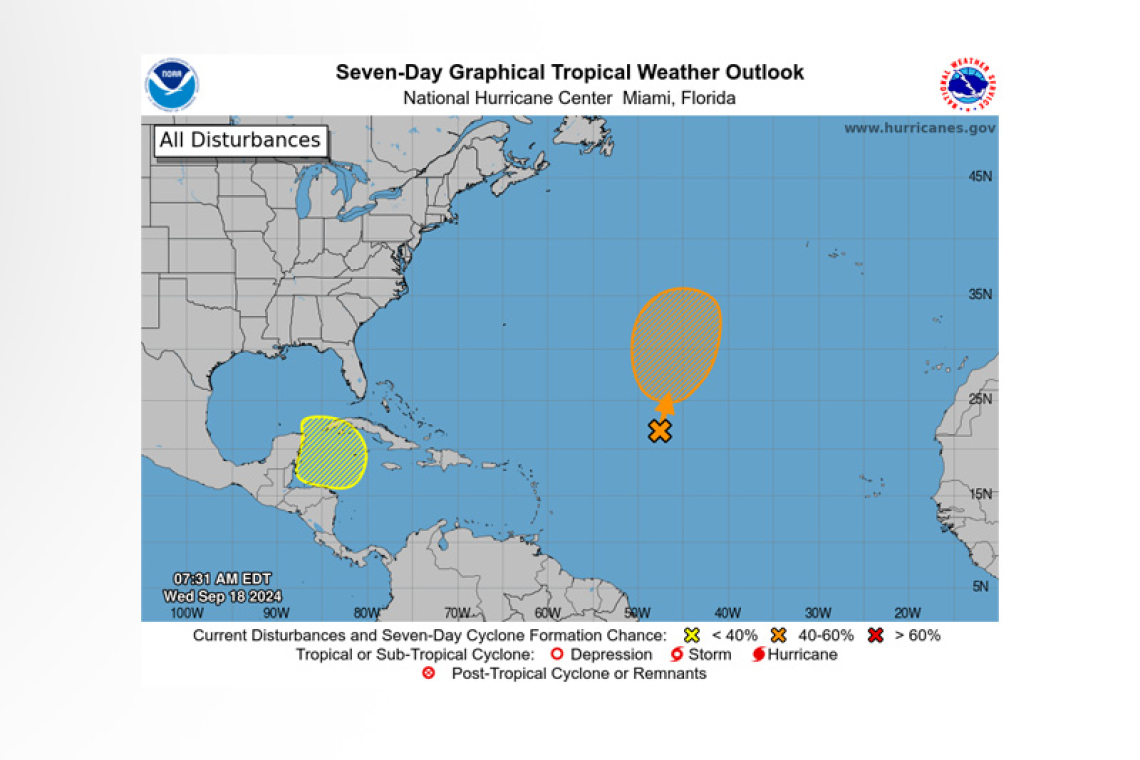
1. Central Subtropical Atlantic (Remnants of Gordon):
Showers and thunderstorms remain disorganized over the central tropical Atlantic in association with the remnants of Gordon. This system is forecast to interact with a non-tropical low to its northwest while moving north-northeastward at 5 to 10 mph during the next couple of days. Environmental conditions could become more conducive for development later this week, and a tropical depression or storm could re-form in a few days while the system moves slowly northward over the central sub-tropical Atlantic.
* Formation chance through 48 hours...low...30 percent.
* Formation chance through 7 days...medium...60 percent.
2. Northwestern Caribbean Sea:
 A broad area of low pressure could form late this weekend or early next week over the northwestern Caribbean Sea. Thereafter, some slow development of this system is possible through the middle of next week while it moves slowly to the north or northwest over the northwestern Caribbean Sea or the southeastern Gulf of Mexico.
* Formation chance through 48 hours...low...near 0 percent.
* Formation chance through 7 days...low...20 percent.
Forecaster Pasch


