
DATE ISSUED: Monday, 12 August 2024 @ 12:00 LST (16:00 UTC)
VALID UNTIL: Tuesday midday (12:00 LST) 13 August 2024
…TROPICAL STORM WARNING IN EFFECT FOR ST. MAARTEN...
…A SMALL CRAFT ADVISORY IS IN EFFECT UNTIL FURTHER NOTICE…
WEATHER:
This afternoon: Partly cloudy with light haze, becoming cloudy and breezy at times with brief local showers.
Tonight through Tuesday midday: Partly cloudy to cloudy and breezy with isolated showers and possible thunderstorms.
Forecast High: 32°C / 90°F
Forecast Low: 26°C / 79°F
Sunset Today: 6:41 P.M.
Sunrise Tomorrow: 5:54 A.M.
SURFACE WINDS:
This afternoon through Tuesday midday: East-northeasterly to northeasterly with a gentle to fresh breeze of 10 to 20 mph, and occasional higher gusts.
SYNOPSIS:
Patches of moisture tracking over the island, ahead of Potential Tropical Cyclone #5 will cause brief showers across the local area. However, a deteriorating weather pattern is expected towards the end of the forecast period with increasing showers, winds, and seas. Therefore residents and visitors are advised to be on alert for future alerts.
Moderate to rough seas, up to 9 feet, are expected through the next 6 or so hours before deteriorating further. Small craft-operators and swimmers are advised to exercise caution, while protecting life and property.
STATE OF THE SEA: Moderate to rough
WAVES/SWELLS: 5 to 9 feet
SPECIAL FEATURE:
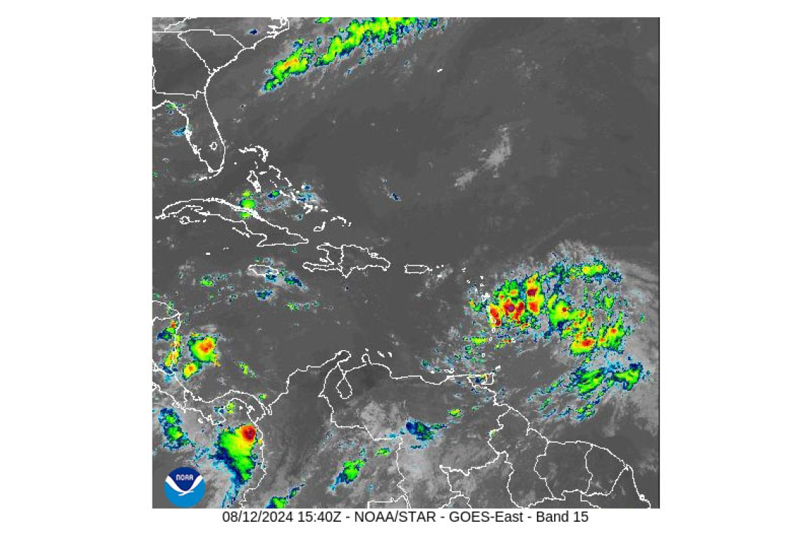
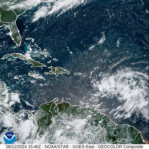
At 11:00am, Potential Tropical Cyclone #5 continues to move quickly towards the Lesser Antilles, while getting more organized. St. Maarten is now under a Tropical Storm Warning as of 8:00am.
- At 11:00am, Potential Tropical Cyclone #5 was located at 15.1N 55.6W, or approximately 540 miles east-southeast of St. Maarten.
- This system is moving quickly west at 26 mph (43 km/h) with maximum sustained winds increased to 35 mph (55 km/h) and higher gusts. Further strengthening is forecast, and the system is expected to become a tropical storm later today or tonight.
- Based on the current forecast track, its closest point will be approximately 85 miles south of St. Maarten on Tuesday evening.
The public is urged to finalize preparations to protect life and property, while monitoring subsequent updates.
The Meteorological Department of St. Maarten will continue to monitor the progress of this system and update the public accordingly.
OUTLOOK through Wednesday midday: Cloudy and windy scattered showers and isolated thunderstorms.
FORECASTER: Connor
3-DAY FORECAST
|
DAY
|
Monday
|
Tuesday
|
Wednesday
|
|
WEATHER
|
Partly Cloudy/Cloudy,
Breezy, Light Haze,
Local Showers
|
Partly Cloudy/Cloudy,
Windy, Isolated Showers,
possible Thunderstorms
|
Cloudy, Windy,
Scattered Showers,
Isolated Thunderstorms
|
|
HIGH TEMP
|
32°C / 90°F
|
31°C / 87°F
|
30°C / 86°F
|
|
LOW TEMP
|
26°C / 79°F
|
25°C / 77°F
|
24°C / 75°F
|
|
SUNRISE
|
05:54 AM
|
05:54 AM
|
05:55 AM
|
|
SUNSET
|
06:41 PM
|
06:40 PM
|
06:40 PM
|


