BULLETIN
Hurricane Rafael Intermediate Advisory Number 15A
NWS National Hurricane Center Miami FL AL182024
700 AM EST Thu Nov 07 2024
SUMMARY OF 700 AM EST...1200 UTC...INFORMATION
----------------------------------------------
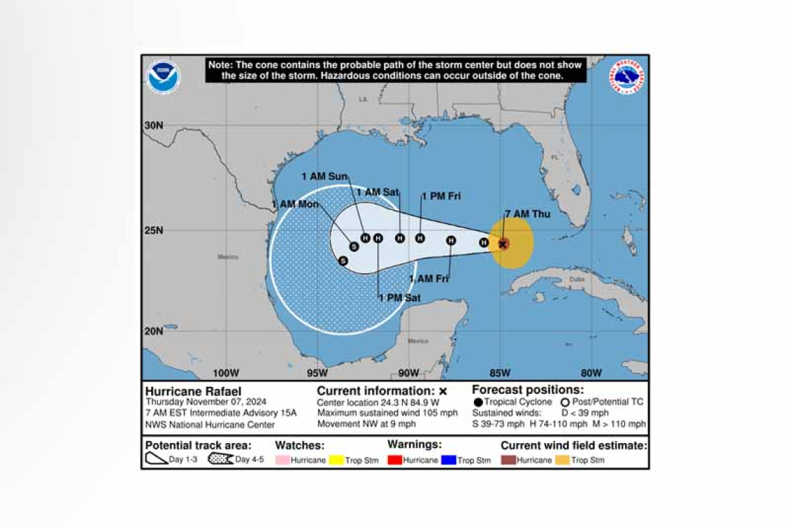
 LOCATION...24.3N 84.9W
ABOUT 180 MI...290 KM WNW OF HAVANA CUBA
ABOUT 195 MI...315 KM W OF KEY WEST FLORIDA
MAXIMUM SUSTAINED WINDS...105 MPH...165 KM/H
PRESENT MOVEMENT...NW OR 305 DEGREES AT 9 MPH...15 KM/H
MINIMUM CENTRAL PRESSURE...970 MB...28.64 INCHES
WATCHES AND WARNINGS
--------------------
CHANGES WITH THIS ADVISORY:
The Tropical Storm Warning for the Dry Tortugas has been discontinued.
SUMMARY OF WATCHES AND WARNINGS IN EFFECT:
There are no coastal watches or warnings in effect.
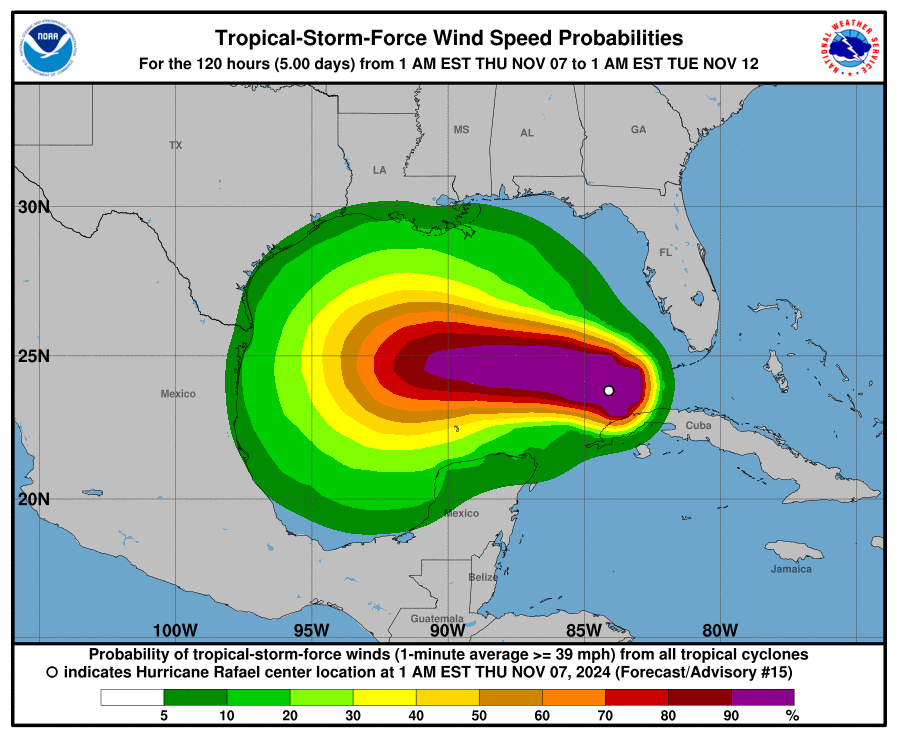
Interests in the southern and southwestern Gulf of Mexico should monitor the progress of Rafael.
DISCUSSION AND OUTLOOK
----------------------
 At 700 AM EST (1200 UTC), the center of Hurricane Rafael was located near latitude 24.3 North, lon-gitude 84.9 West. Rafael is moving toward the northwest near 9 mph (15 km/h). A turn toward the west at a slower forward speed is expected later today, with this general motion continuing through Saturday. On the forecast track, Rafael is expected to move over the southern Gulf of Mexico for the next few days.
Maximum sustained winds are near 105 mph (165 km/h) with higher gusts. Some weakening is antic-ipated during the next few days.
Hurricane-force winds extend outward up to 30 miles (45 km) from the center and tropi-cal-storm-force winds extend outward up to 115 miles (185 km).
The estimated minimum central pressure based on aircraft data is 970 mb (28.64 inches).
HAZARDS AFFECTING LAND
----------------------
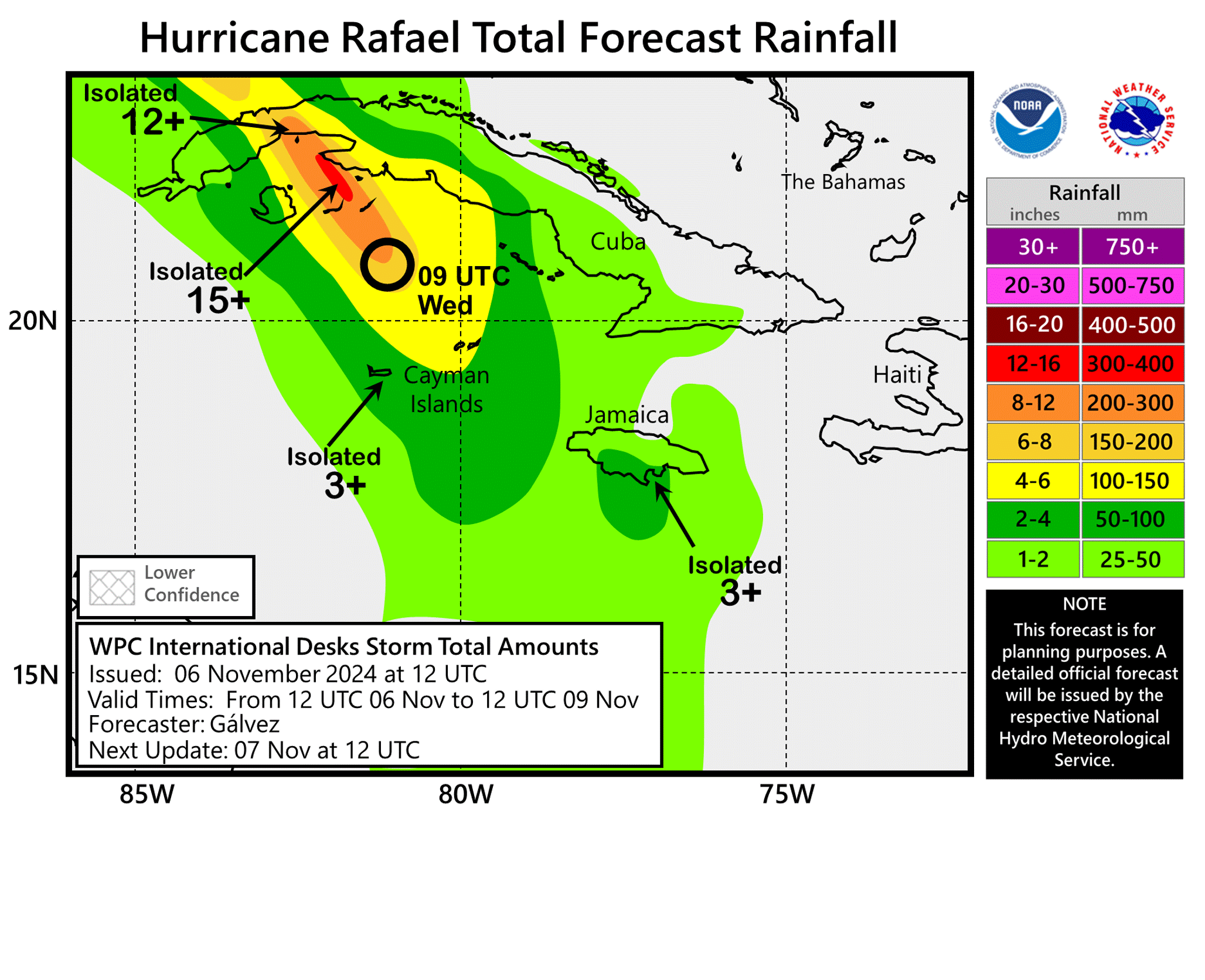
RAINFALL: Additional rainfall amounts of 2 to 4 inches are expected today, leading to storm total ac-cumulations of 12 inches across portions of western Cuba. This may lead to areas of flash flooding and mudslides, especially along the higher terrain.
SURF: Swells generated by Rafael are expected to spread across most of the Gulf of Mexico from east to west during the next several days. These swells are likely to cause life-threatening surf and rip cur-rent conditions. Please consult products from your local weather office.
Forecaster Reinhart


