
Tropical Weather Outlook
NWS National Hurricane Center Miami FL
800 AM EDT Fri Jun 28 2024
For the North Atlantic...Caribbean Sea and the Gulf of Mexico:
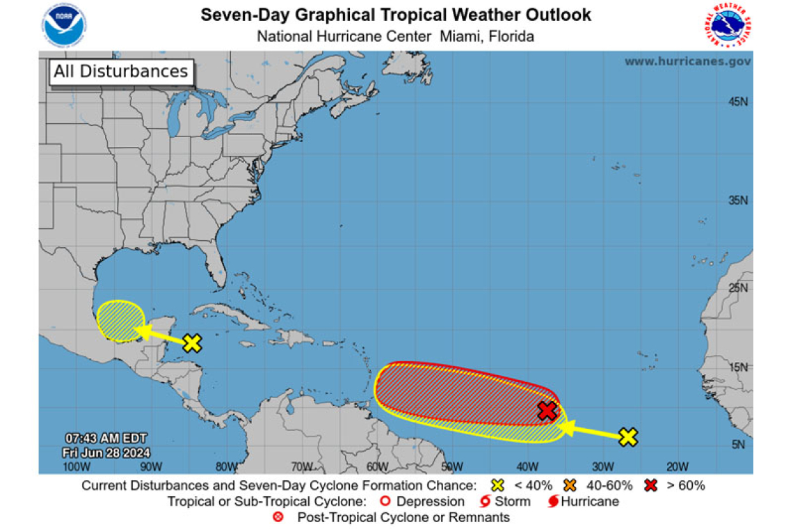
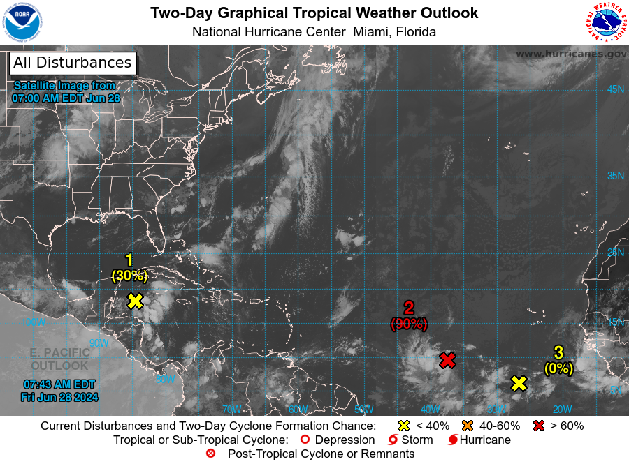
Western Caribbean/Southwestern Gulf of Mexico (AL94):
A broad area of low pressure over the western Caribbean Sea associated with a tropical wave continues to produce widespread shower and thunderstorm activity. Development of this system is not expected today while it moves west-northwestward at around 15 mph, and an Air Force reconnaissance mission planned for today has been canceled. The disturbance is then expected to move westward over the Yucatan Peninsula and emerge over the Bay of Campeche late Saturday or early Sunday, at which point some development will be possible. Regardless of development, heavy rainfall associated with the tropical wave will affect portions of Central America and Mexico through the weekend.
* Formation chance through 48 hours...low...30 percent.
* Formation chance through 7 days...low...30 percent.
Central Tropical Atlantic (AL95):
A low pressure system located about 1500 miles east-southeast of the Windward Islands is gradually becoming better defined. Showers and thunderstorms are also showing signs of organization, and a tropical depression or tropical storm will likely form later today or on Saturday. This system is expected to move westward at 15 to 20 mph and approach the Lesser Antilles by the end of the weekend. Interests there should monitor the progress of this system.
* Formation chance through 48 hours...high...90 percent.
* Formation chance through 7 days...high...90 percent.
Eastern Tropical Atlantic:
A tropical wave centered several hundred miles south-southwest of the Cabo Verde Islands is producing disorganized showers and thunderstorms. Some slow development of this system is possible next week while it moves generally westward across the central and western tropical Atlantic at 15 to 20 mph.
* Formation chance through 48 hours...low...near 0 percent.
* Formation chance through 7 days...low...20 percent.
Forecaster Cangialosi/Zelinsky


