
Tropical Storm Oscar Intermediate Advisory Number 9A
NWS National Hurricane Center Miami FL AL162024
800 AM EDT Mon Oct 21 2024
SUMMARY OF 800 AM EDT...1200 UTC...INFORMATION
----------------------------------------------
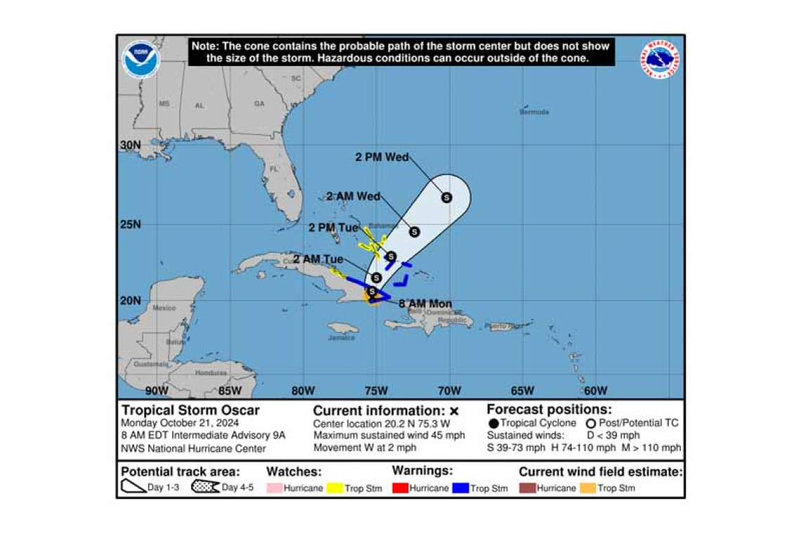
LOCATION...20.2N 75.3W
ABOUT 5 MI...10 KM W OF GUANTANAMO CUBA
ABOUT 70 MI...115 KM W OF THE EASTERN TIP OF CUBA
MAXIMUM SUSTAINED WINDS...45 MPH...75 KM/H
PRESENT MOVEMENT...W OR 270 DEGREES AT 2 MPH...4 KM/H
MINIMUM CENTRAL PRESSURE...1000 MB...29.53 INCHES
WATCHES AND WARNINGS
--------------------
CHANGES WITH THIS ADVISORY:
None
SUMMARY OF WATCHES AND WARNINGS IN EFFECT:
A Tropical Storm Warning is in effect for...
* North coast of the Cuban Provinces of Las Tunas, Holguin, and Guantanamo to Punta Maisi
* South coast of Cuban Province of Guantanamo
* Southeastern Bahamas
A Tropical Storm Watch is in effect for...
* North coast of the Cuban Province of Camaguey
* Central Bahamas
 A Tropical Storm Warning means that tropical storm conditions are expected somewhere within the warning.
A Tropical Storm Watch means that tropical storm conditions are possible within the watch area, in this case within the next 24 to 36 hours.
Interests in the remainder of the Bahamas should monitor the progress of Oscar.
For storm information specific to your area, please monitor products issued by your national meteor-ological service.
DISCUSSION AND OUTLOOK
----------------------
At 800 AM EDT (1200 UTC), the center of Tropical Storm Oscar was located near latitude 20.2 North, longitude 75.3 West. Oscar is moving toward the west near 2 mph (4 km/h). A turn to the northwest and north is expected later today, followed by a faster northeastward motion on Tuesday and Wednesday. On the forecast track, the center of Oscar is expected to continue moving across eastern Cuba through this afternoon, then emerge off the northern coast of Cuba late today or tonight and move near the southeastern and central Bahamas on Tuesday.
Maximum sustained winds have decreased to near 45 mph (75 km/h) with higher gusts. Some addi-tional weakening could occur while Oscar moves across the mountainous terrain of eastern Cuba, but Oscar is forecast to be a tropical storm when it moves north of Cuba late today and then moves near the southeastern and central Bahamas on
Tuesday.
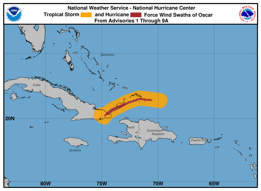
Tropical-storm-force winds extend outward up to 45 miles (75 km) from the center.
The estimated minimum central pressure is 1000 mb (29.53 inches).
HAZARDS AFFECTING LAND
----------------------
 WIND: Tropical storm conditions are expected in the warning area and possible in the watch area of Cuba today. Tropical storm conditions are expected in the warning area in parts of the southeastern Bahamas and are possible in the watch area in parts of the central Bahamas tonight and Tuesday.
RAINFALL: Through Wednesday morning, rainfall amounts of 7 to 14 inches with isolated amounts of 20 inches are expected across eastern Cuba, especially within the Sierra Maestra. This rainfall will lead to areas of significant, life-threatening flash flooding along with mudslides.
Across the southeastern Bahamas, 3 to 5 inches of rain are expected, with isolated amounts around 8 inches. This rainfall could cause localized flash flooding.
STORM SURGE: Elevated water levels in areas of onshore winds along the coast of eastern Cuba will gradually subside later today and tonight. Near the coast, large and dangerous waves will continue into early Tuesday.
Forecaster Pasch


