...HEAVY RAINS LINGERING OVER PORTIONS OF THE LEEWARD ISLANDS...
Hurricane Tammy Advisory Number 21
NWS National Hurricane Center Miami FL AL202023
1100 AM AST Mon Oct 23 2023
SUMMARY OF 1100 AM AST...1500 UTC...INFORMATION
-----------------------------------------------
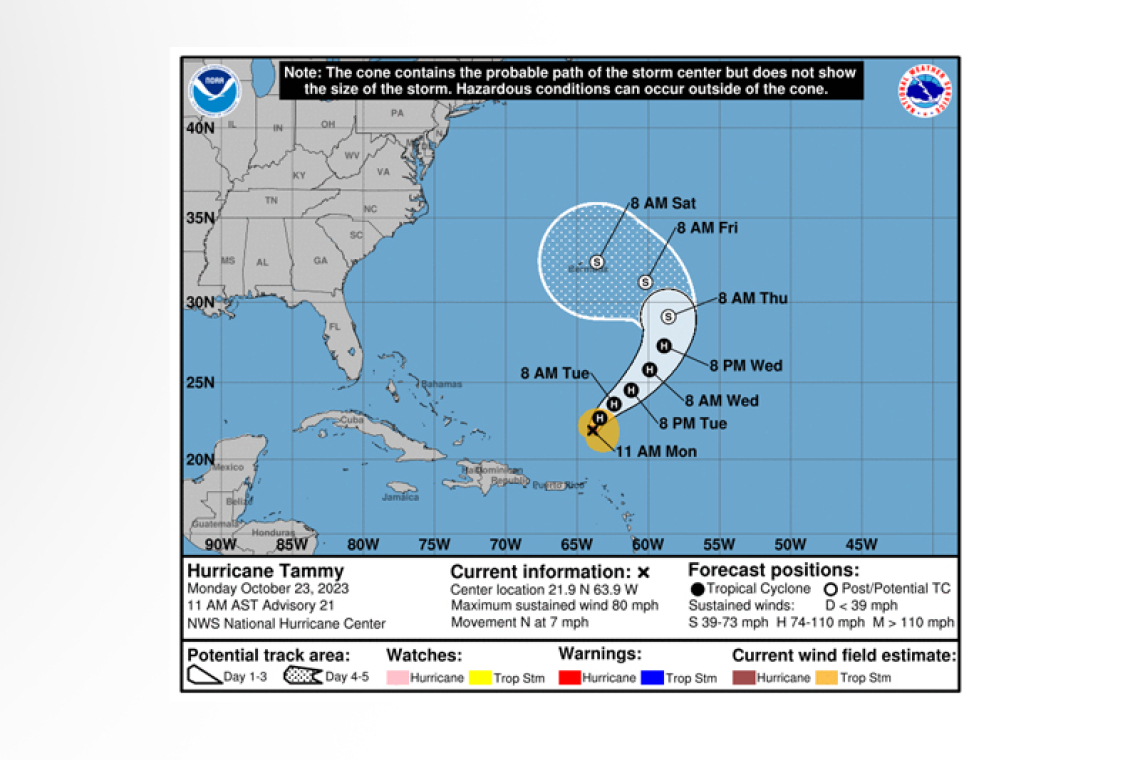
LOCATION...21.9N 63.9W
ABOUT 260 MI...420 KM N OF ANGUILLA
MAXIMUM SUSTAINED WINDS...80 MPH...130 KM/H
PRESENT MOVEMENT...N OR 5 DEGREES AT 7 MPH...11 KM/H
MINIMUM CENTRAL PRESSURE...993 MB...29.33 INCHES
WATCHES AND WARNINGS
--------------------
There are no coastal watches or warnings in effect.
DISCUSSION AND OUTLOOK
----------------------
At 1100 AM AST (1500 UTC), the center of Hurricane Tammy was located near latitude 21.9 North, longitude 63.9 West. Tammy is moving toward the north near 7 mph (11 km/h). A turn toward the north-northeast or northeast is expected to begin later today and continue into Tuesday.
Maximum sustained winds are near 80 mph (130 km/h) with higher gusts. Some slight strengthening is possible during the next day or so followed by weakening.
Hurricane-force winds extend outward up to 25 miles (35 km) from the center and tropi-cal-storm-force winds extend outward up to 125 miles (205 km).
The estimated minimum central pressure is 993 mb (29.33 inches).
HAZARDS AFFECTING LAND
----------------------
RAINFALL: Rain bands south of Hurricane Tammy are expected to produce an additional 1 to 3 inches of rainfall across portions of the Virgin Islands and northern Leeward Islands today, bringing storm total maximum amounts to 12 inches in the Leeward Islands. The additional rainfall may produce iso-lated flash and urban flooding, along with isolated mudslides in areas of higher terrain.
 SURF: Swells generated by Tammy will continue to affect portions of the Leeward Islands, the British and U.S. Virgin Islands, and Puerto Rico during the next few days. These swells are likely to cause life-threatening surf and rip current conditions. Please consult products from your local weather of-fice.
Forecaster Bucci


