
NWS National Hurricane Center Miami FL
800 AM EDT Fri Jun 21 2024
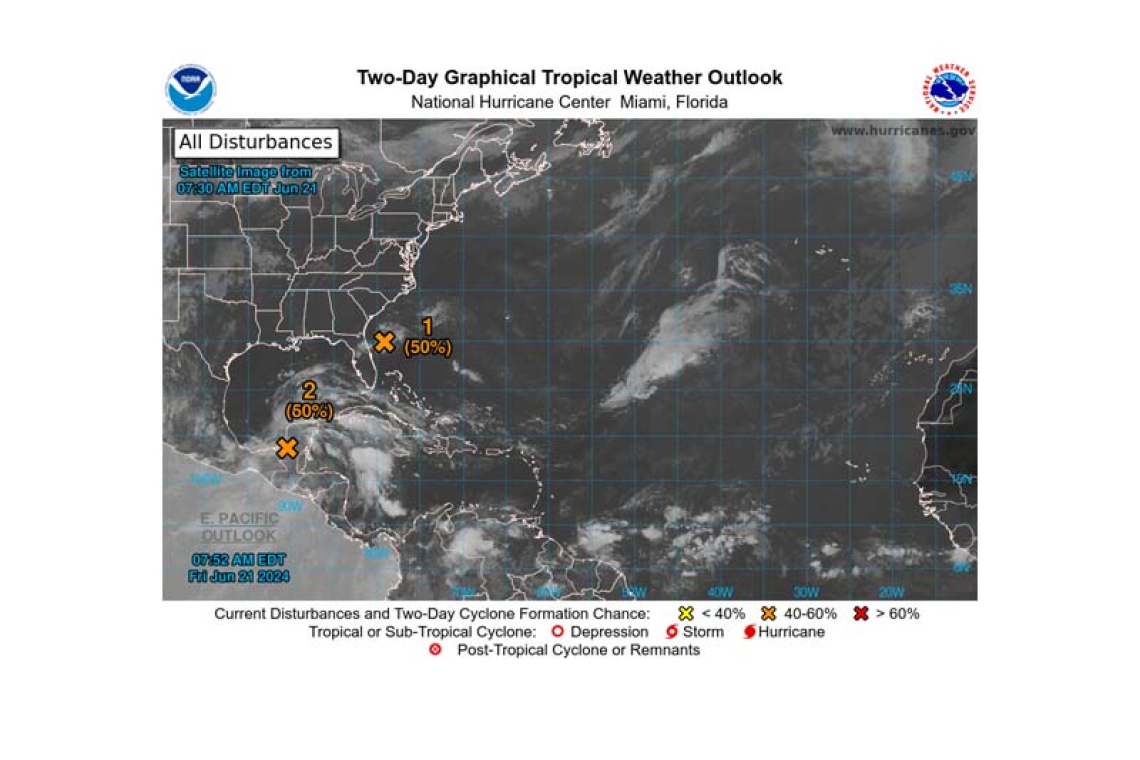
For the North Atlantic...Caribbean Sea and the Gulf of Mexico:
1. Southwestern Atlantic Ocean (AL92):
 A small area of showers and thunderstorms persists with a low pressure system located around 150 miles east-southeast of Jacksonville, Florida. An Air Force Reserve aircraft is currently investigating the system to determine if the low has a well-defined surface circulation. Environmental conditions re-main marginally conducive for some additional development, and this system could become a short-lived tropical depression as the low moves west-northwestward at 10 to 15 mph. The system is expected to reach the coast of northeastern Florida or Georgia by tonight, and interests there should monitor its progress.
* Formation chance through 48 hours...medium...50 percent.
* Formation chance through 7 days...medium...50 percent.
2. Southwestern Gulf of Mexico:
A broad area of low pressure is forecast to form over southeastern Mexico later today. Environ-mental conditions appear conducive for gradual development after this system moves over the Bay of Campeche tonight, and a tropical depression could form over the southwestern Gulf of Mexico this weekend while it moves slowly west-northwestward or northwestward. Interests along the Gulf coast of Mexico should monitor the progress of this system.
* Formation chance through 48 hours...medium...50 percent.
* Formation chance through 7 days...medium...60 percent.
Forecaster Hagen/Berg


