NWS National Hurricane Center Miami FL
800 AM EDT Wed Aug 28 2024
For the North Atlantic...Caribbean Sea and the Gulf of Mexico:
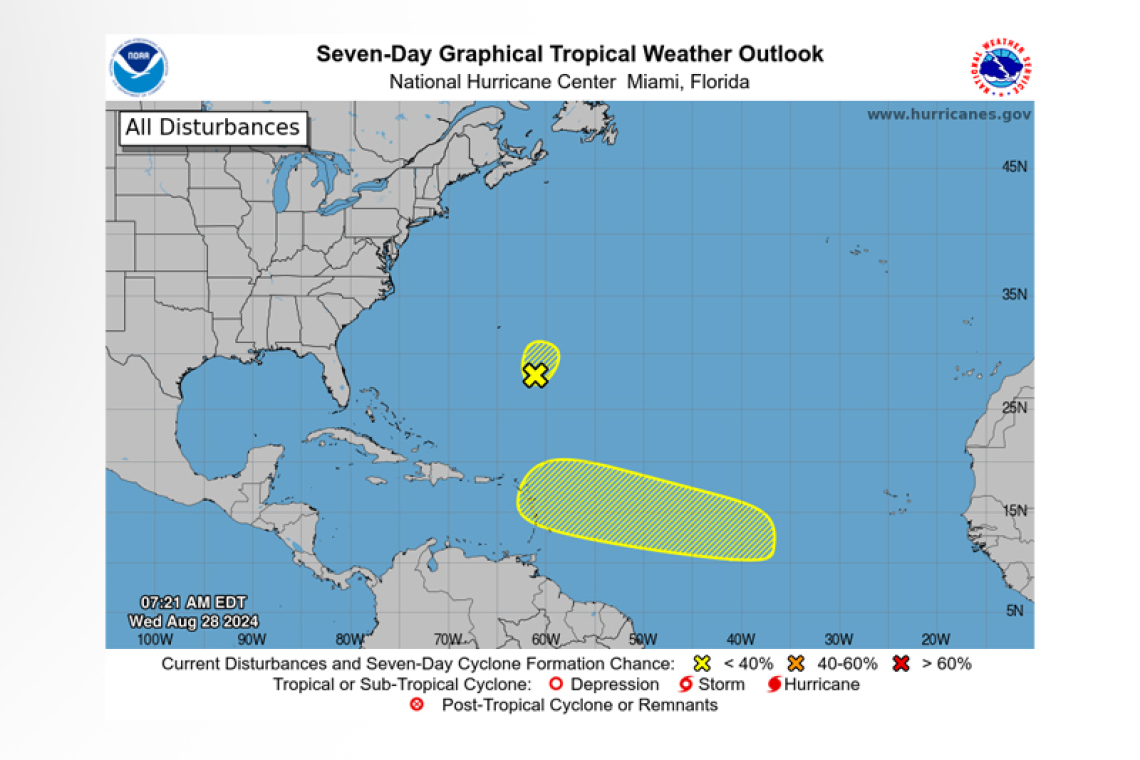
1. Western Atlantic:
An area of low pressure located a few hundred miles southeast of Bermuda is producing a small area of disorganized shower and thunderstorm activity. Dry air and strong upper-level winds are expected to limit additional development of this system during the next day or so while the low moves northward to north-northeastward at around 10 mph.
 * Formation chance through 48 hours...low...10 percent.
* Formation chance through 7 days...low...10 percent.
2. Central Tropical Atlantic:
An area of low pressure could form in the central portion of the Tropical Atlantic in a few days. Thereafter, environmental conditions appear generally favourable for some slow development of the system this weekend into early next week while it moves westward to west-northwestward at 10 to 15 mph.
* Formation chance through 48 hours...low...near 0 percent.
* Formation chance through 7 days...low...20 percent.
Forecaster Reinhart


