NWS National Hurricane Center Miami FL
800 AM EDT Thu Sep 19 2024
For the North Atlantic...Caribbean Sea and the Gulf of Mexico:
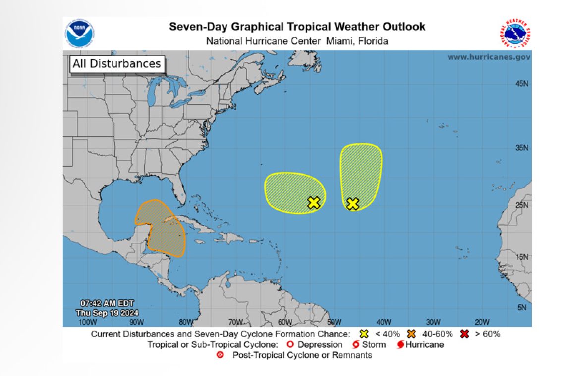
1. Central Subtropical Atlantic (Remnants of Gordon):
An area of disorganized showers and thunderstorms located over the central subtropical Atlantic is associated with the remnants of Gordon. Some development of this system is possible while it moves generally northward over the next several days.
 * Formation chance through 48 hours...low...20 percent.
* Formation chance through 7 days...low...30 percent.
2. Central and Western Subtropical Atlantic:
An area of low pressure located about 750 miles southeast of Bermuda is producing disorganized showers and thunderstorms. Environmental conditions appear only marginally conducive, but some development of this system is possible while it meanders over the open waters of the central or western Subtropical Atlantic though early next week.
* Formation chance through 48 hours...low...10 percent.
* Formation chance through 7 days...low...20 percent.
3. Northwestern Caribbean Sea and Southeastern Gulf of Mexico:
A broad area of low pressure could form by early next week over the western and northwestern Car-ibbean Sea. Thereafter, gradual development of this system is possible, and a tropical depression could form as the system moves slowly to the north or northwest over the northwestern Caribbean Sea and into the southern Gulf of Mexico through the middle part of next week.
* Formation chance through 48 hours...low...near 0 percent.
* Formation chance through 7 days...medium...40 percent.
Forecaster Pasch


