NWS National Hurricane Center Miami FL
800 AM EDT Fri Sep 20 2024
For the North Atlantic...Caribbean Sea and the Gulf of Mexico:
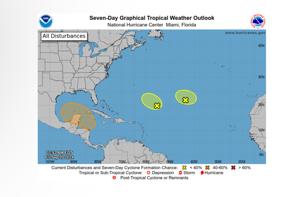
1. Central Subtropical Atlantic (Remnants of Gordon):
An area of low pressure, associated with the remnants of Gordon, is producing disorganized showers and thunderstorms more than a thousand miles southwest of the Azores. Due to strong upper-level winds, any additional development of this system is expected to be slow to occur while it meanders over the central subtropical Atlantic during the next couple of days.
* Formation chance through 48 hours...low...20 percent.
* Formation chance through 7 days...low...20 percent.
2. Central and Western Subtropical Atlantic (AL96):
 Shower activity associated with an area of low pressure located about 650 miles northeast of the northern Leeward Islands has changed little in organization over the past several hours. Environmen-tal conditions appear only marginally conducive for some development of this system during the next couple of days while it drifts northwestward at about 5 mph over the central or western subtropical Atlantic.
* Formation chance through 48 hours...low...20 percent.
* Formation chance through 7 days...low...20 percent.
3. Northwestern Caribbean Sea and Southern Gulf of Mexico:
A broad area of low pressure could form by the early to middle part of next week over the north-western Caribbean Sea. Thereafter, gradual development of this system is possible, and a tropical de-pression could form as the system moves slowly to the north or northwest over the northwestern Caribbean Sea and into the southern Gulf of Mexico through the end of next week.
* Formation chance through 48 hours...low...near 0 percent.
* Formation chance through 7 days...medium...40 percent.
Forecaster Berg


