NWS National Hurricane Center Miami FL
800 AM EDT Mon Sep 23 2024
For the North Atlantic...Caribbean Sea and the Gulf of Mexico:
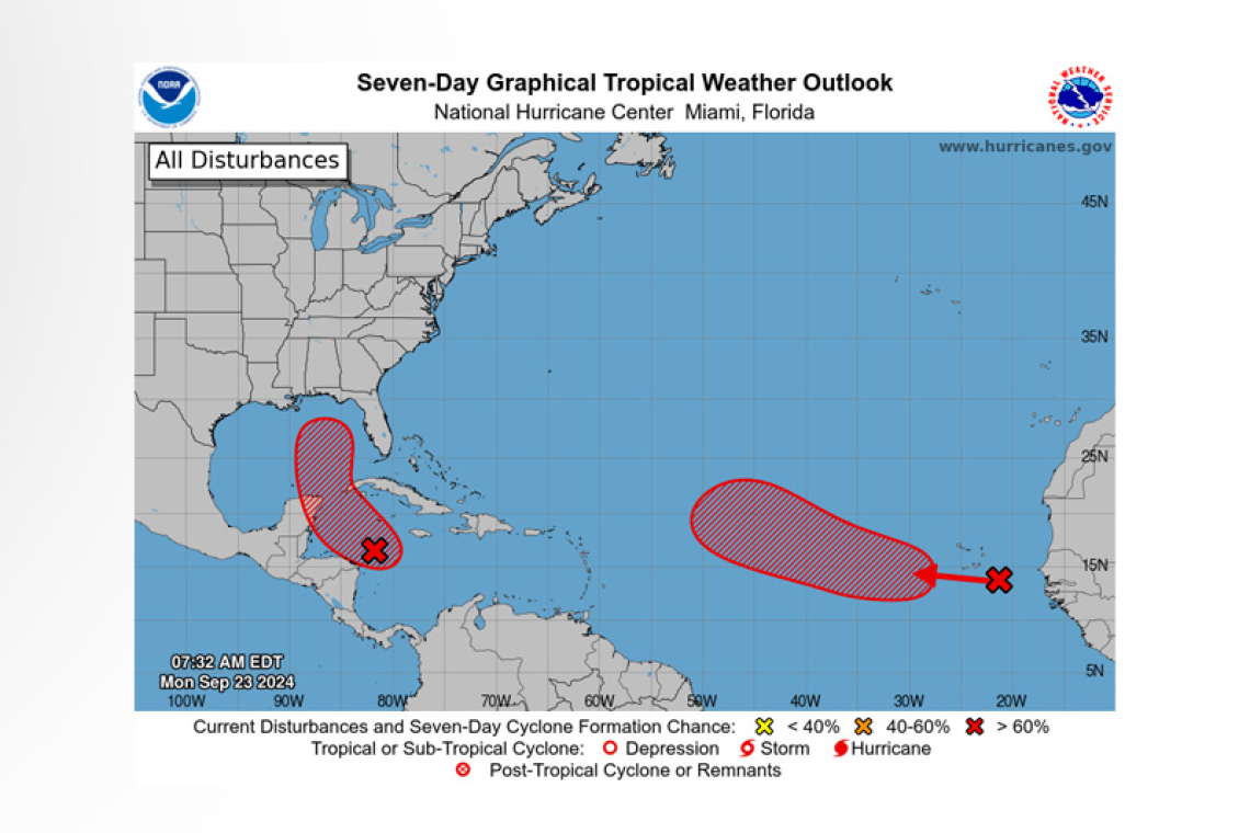
1. Northwestern Caribbean Sea and Gulf of Mexico (AL97):
Showers and thunderstorms are gradually becoming better organized in association with a broad area of low pressure located over the northwestern Caribbean Sea. Environmental conditions appear fa-vorable for further development of this system. A tropical depression or storm is likely to form within the next day or two as the system moves northward across the northwestern Caribbean Sea and into the southeastern Gulf of Mexico, where additional development is expected. Regardless of develop-ment, this system is expected to produce heavy rains over portions of Central America during the next several days. Interests in the northwestern Caribbean, the Yucatan Peninsula of Mexico, and western Cuba should closely monitor the progress of this system, as watches or warnings will likely be re-quired later this morning for portions of these areas. Later this week, the system is forecast to move generally northward across the eastern Gulf of Mexico, and interests along the northern and north-eastern Gulf Coast should also closely monitor the progress of this system.
 * Formation chance through 48 hours...high...80 percent.
* Formation chance through 7 days...high...90 percent.
2. Eastern and Central Tropical Atlantic:
A tropical wave located between western Africa and the Cabo Verde Islands is producing disorganized shower and thunderstorm activity. Environmental conditions appear generally favorable for gradual development of this system, and a tropical depression is likely to form during the middle to latter part of this week while it moves westward to west-northwestward across the eastern and central tropical Atlantic.
* Formation chance through 48 hours...low...20 percent.
* Formation chance through 7 days...high...70 percent.
Forecaster Reinhart


