NWS National Hurricane Center Miami FL
800 AM EDT Wed Oct 16 2024
For the North Atlantic...Caribbean Sea and the Gulf of Mexico:
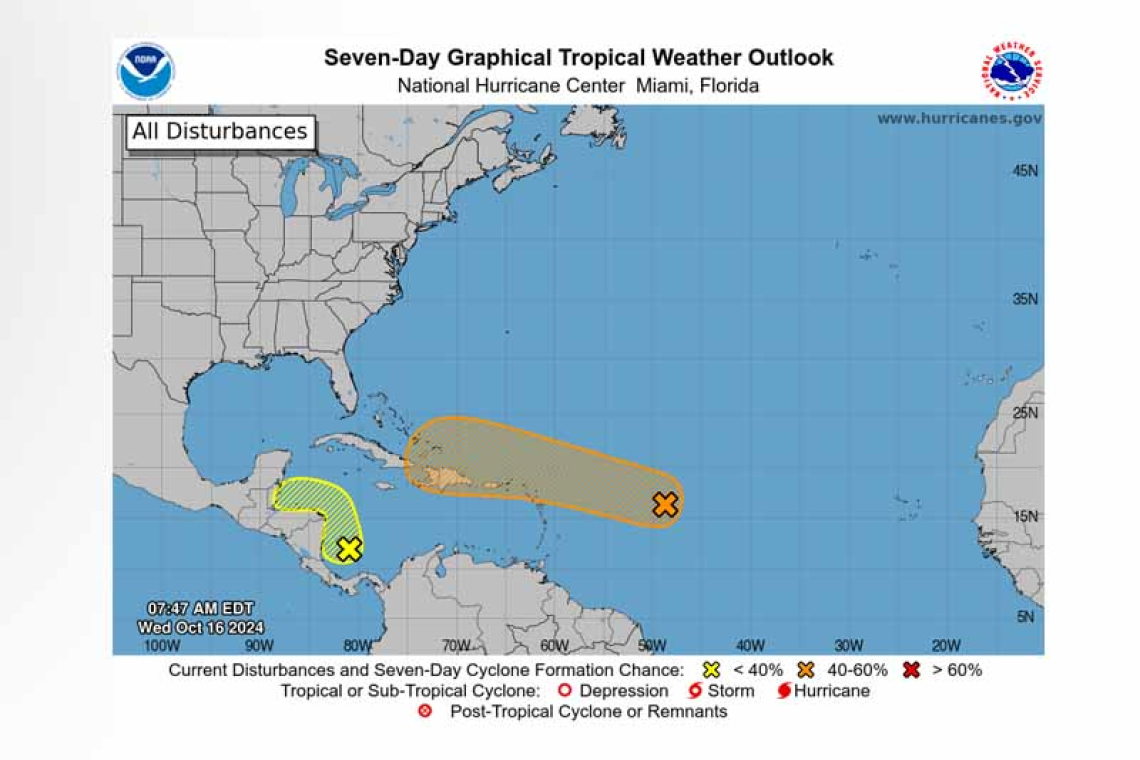
1. Central Tropical Atlantic (AL94):
 A broad area of low pressure located over the central tropical Atlantic is producing disorganized showers and thunderstorms. This system is forecast to move generally westward to west-northwestward, and environmental conditions appear marginally conducive for gradual devel-opment during the latter part of this week. A tropical depression could form as the system moves near the Leeward and Virgin Islands late this week.
* Formation chance through 48 hours...low...30 percent.
* Formation chance through 7 days...medium...40 percent.
2. Western Caribbean Sea:
Showers and thunderstorms over the southwestern Caribbean Sea are associated with a broad area of low pressure. Some gradual development is possible if the system stays over water while it moves slowly northwestward towards Central America. Regardless of development, locally heavy rainfall is possible across portions of Central America later this week.
* Formation chance through 48 hours...low...10 percent.
* Formation chance through 7 days...low...20 percent.
Forecaster Bucci/R. Zelinsky


