NWS National Hurricane Center Miami FL
800 AM EDT Sat Aug 31 2024
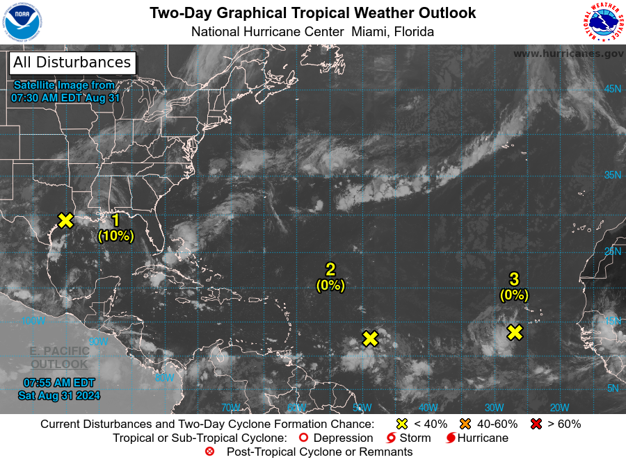
1. Northwestern Gulf of Mexico:
A broad area of low pressure near the upper Texas coast is producing some disorganized showers and thunderstorms along and just offshore the coasts of Texas and Louisiana. This system is expected to linger near the coast through much of next week, and some slow development is possible if it meanders offshore. Regardless of development, heavy rains could cause some flash flooding across portions of coastal Louisiana and the upper Texas coast during the next few
days.
* Formation chance through 48 hours...low...10 percent.
* Formation chance through 7 days...low...20 percent.
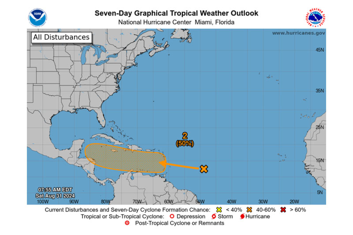
2. Near the Lesser Antilles and Caribbean Sea:
A tropical wave located several hundred miles east of the Lesser Antilles continues to produce some disorganized showers and thunderstorms. The disturbance is forecast to move westward and reach the Lesser Antilles on Monday. Thereafter, environmental conditions appear conducive for gradual development of this system, and a tropical depression could form while it continues moving westward across the Caribbean Sea through the middle to latter part of the week.
* Formation chance through 48 hours...low...near 0 percent.
* Formation chance through 7 days...medium...50 percent.
3. Eastern Tropical Atlantic:
Another tropical wave located just to the west of the Cabo Verde Islands is producing disorganized shower and thunderstorm activity. Development, if any, should be slow to occur while the system moves slowly westward to west-northwestward over the eastern and central tropical Atlantic through late next week.
* Formation chance through 48 hours...low...near 0 percent.
* Formation chance through 7 days...low...10 percent.

Forecaster Reinhart/Mahoney


