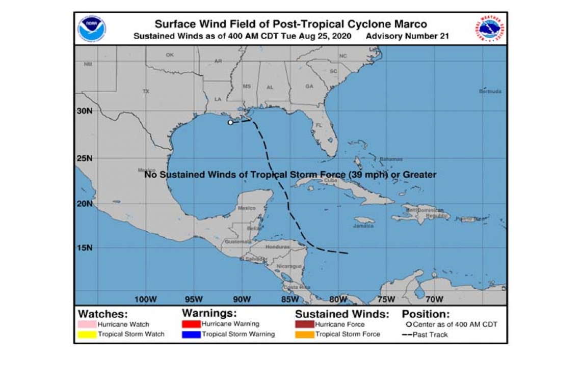
Post-Tropical Cyclone Marco Advisory Number 21
NWS National Hurricane Center Miami FL AL142020
400 AM CDT Tue Aug 25 2020
SUMMARY OF 400 AM CDT...0900 UTC...INFORMATION
----------------------------------------------
LOCATION...28.8N 91.2W
ABOUT 60 MI...100 KM S OF MORGAN CITY LOUISIANA
ABOUT 110 MI...175 KM SSE OF LAFAYETTE LOUISIANA
MAXIMUM SUSTAINED WINDS...30 MPH...45 KM/H
PRESENT MOVEMENT...W OR 270 DEGREES AT 10 MPH...17 KM/H
MINIMUM CENTRAL PRESSURE...1008 MB...29.77 INCHES
WATCHES AND WARNINGS
--------------------
There are no coastal watches or warnings in effect.
DISCUSSION AND OUTLOOK
----------------------
At 400 AM CDT (0900 UTC), the center of Post-Tropical Cyclone Marco was located near latitude 28.8 North, longitude 91.2 West. The post-tropical cyclone is moving toward the west near 10 mph (17 km/h), and this general motion is expected to continue for the next day or so. On the forecast track, Marco should continue moving westward just offshore the coast of Louisiana until the system dissipates.
Maximum sustained winds are near 30 mph (45 km/h) with higher gusts.Additional weakening is expected, and Post-Tropical Cyclone Marco is forecast to dissipate by early Wednesday, if not sooner.
The estimated minimum central pressure is 1008 mb (29.77 inches).
HAZARDS AFFECTING LAND
----------------------
SURF: Swells and rip currents affecting the north-central Gulf coast will gradually subside today. Please consult products from your local weather service office.
This is the last public advisory issued by the National Hurricane
Center on Marco.
Forecaster Stewart


