
NWS National Hurricane Center Miami FL
800 AM EDT Thu Oct 17 2024
For the North Atlantic...Caribbean Sea and the Gulf of Mexico:
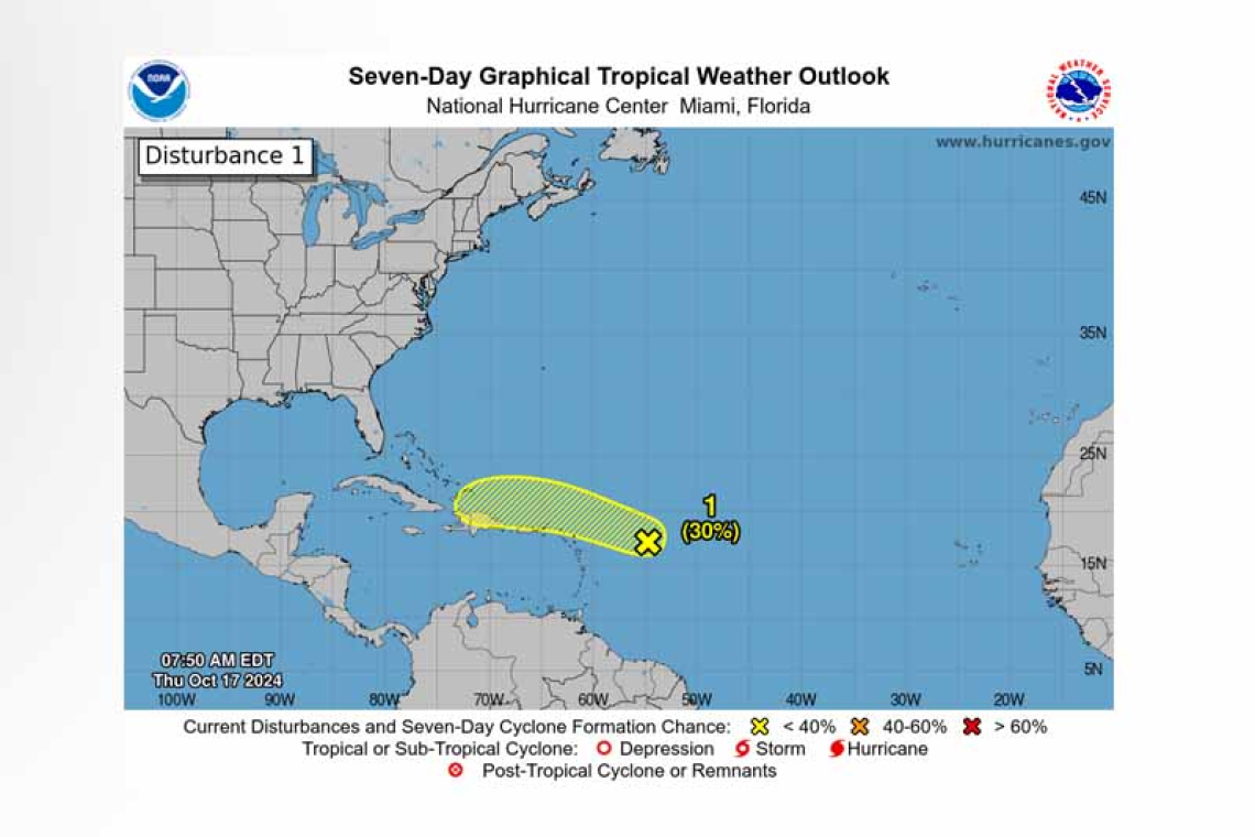
East of the Leeward Islands (AL94):
Showers and thunderstorms associated with a trough of low pressure located a few hundred miles east of the Leeward Islands remain disorganized. Some slow development is possible during the next few days as the disturbance moves quickly westward to west-northwestward around 20 mph, passing near the Virgin Islands and Puerto Rico on Friday, then near Hispaniola and the southeastern Bahamas on Saturday. Strong upper-level winds should end the chances of development by late in the week-end.
* Formation chance through 48 hours...low...20 percent.
* Formation chance through 7 days...low...30 percent.
Western Caribbean Sea:
 Showers and thunderstorms over the western Caribbean Sea are associated with a broad area of low pressure. Some gradual development is possible over the next couple of days before it moves inland over Central America. Regardless of development, locally heavy rainfall is likely across portions of Central America and
southern Mexico through the weekend.
* Formation chance through 48 hours...low...20 percent.
* Formation chance through 7 days...low...20 percent.
Forecaster Cangialosi/Hadi


