
Tropical Storm Milton Advisory Number 2
NWS National Hurricane Center Miami FL AL142024
400 PM CDT Sat Oct 05 2024
SUMMARY OF 400 PM CDT...2100 UTC...INFORMATION
----------------------------------------------
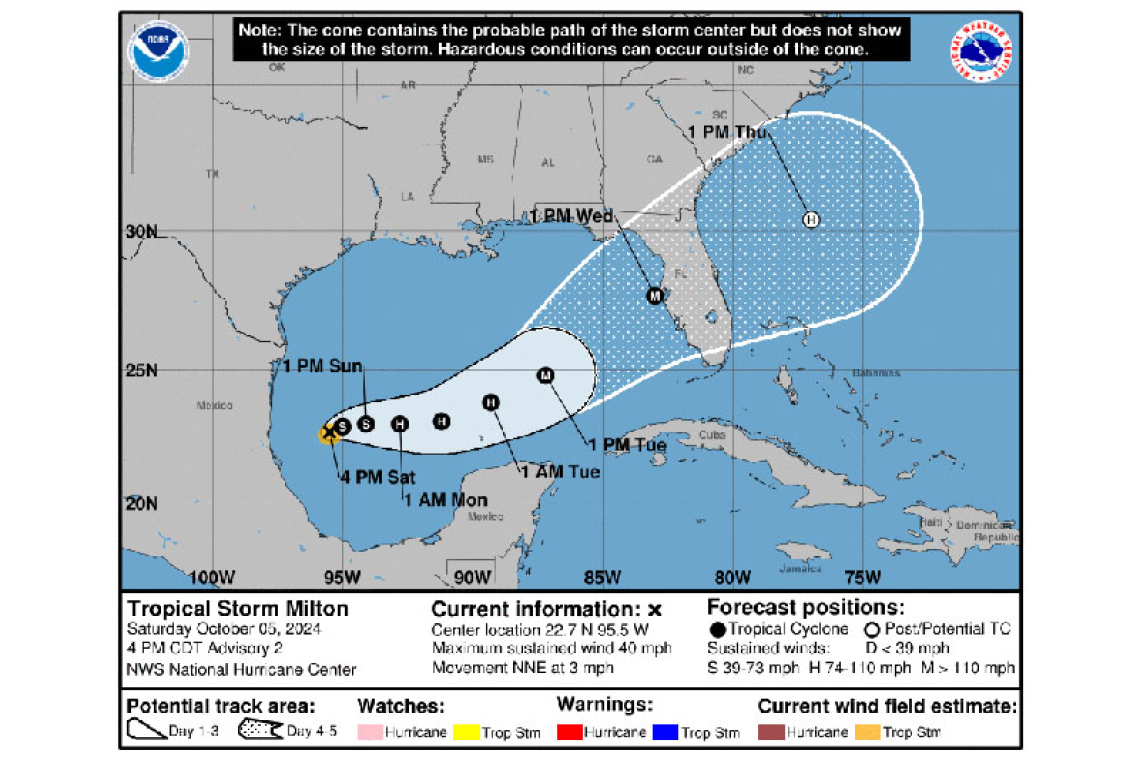
LOCATION...22.7N 95.5W
ABOUT 245 MI...395 KM N OF VERACRUZ MEXICO
ABOUT 385 MI...615 KM WNW OF PROGRESO MEXICO
MAXIMUM SUSTAINED WINDS...40 MPH...65 KM/H
PRESENT MOVEMENT...NNE OR 20 DEGREES AT 3 MPH...6 KM/H
MINIMUM CENTRAL PRESSURE...1006 MB...29.71 INCHES
WATCHES AND WARNINGS
--------------------
There are no coastal watches or warnings in effect.
Interests in the Yucatan peninsula of Mexico, the Florida Peninsula, the Florida Keys, and the northwestern Bahamas should monitor the progress of this system.
Hurricane and Storm Surge watches will likely be required for portions of Florida on Sunday.
DISCUSSION AND OUTLOOK
----------------------
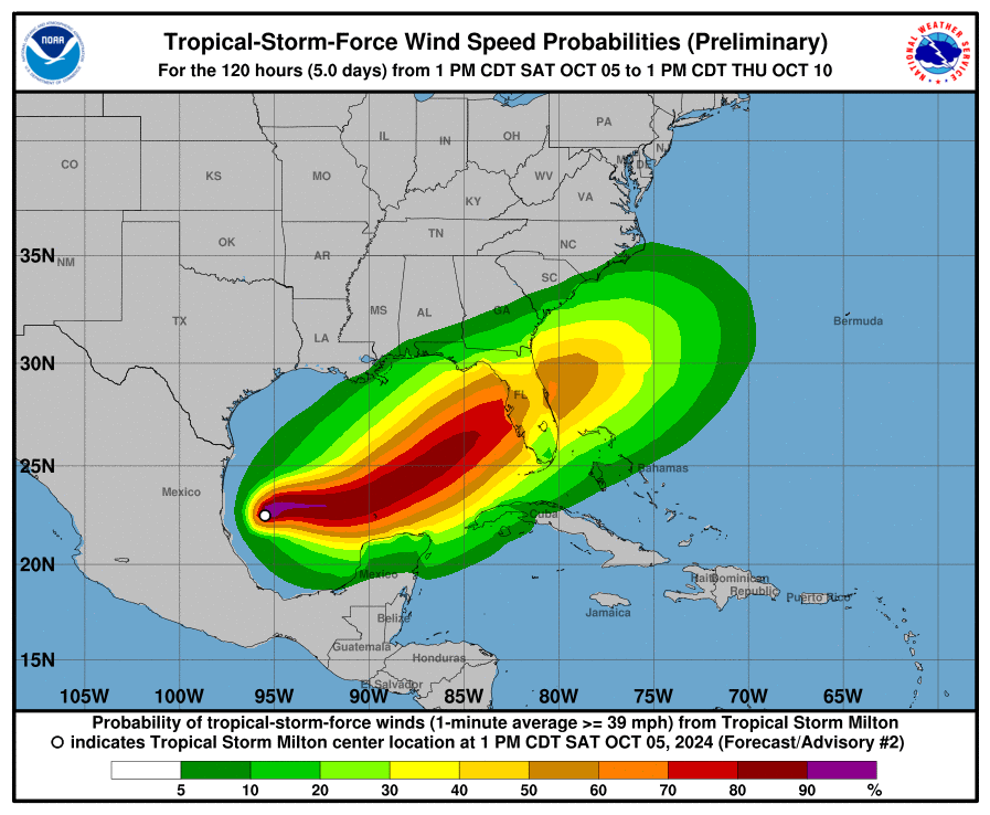
At 400 PM CDT (2100 UTC), the center of Tropical Storm Milton was located near latitude 22.7 North, longitude 95.5 West. Milton is moving toward the north-northeast near 3 mph (6 km/h). A slow east-northeastward motion is expected to begin tonight. A slightly faster eastward to east-northeastward motion is forecast by Monday and Tuesday. On the forecast track, the storm is forecast to remain over the southwestern Gulf of Mexico through Sunday night, then move across the south-central Gulf of Mexico on Monday and Tuesday, and approach the west coast of the Florida Peninsula by midweek.
Maximum sustained winds are near 40 mph (65 km/h) with higher gusts. Steady to rapid strengthening is forecast during the next few days. Milton is forecast to become a hurricane Sunday night, and it could become a major hurricane while it moves across the central and eastern Gulf of Mexico.
Tropical-storm-force winds extend outward up to 35 miles (55 km) from the center.
The estimated minimum central pressure is 1006 mb (29.71 inches).
HAZARDS AFFECTING LAND
----------------------
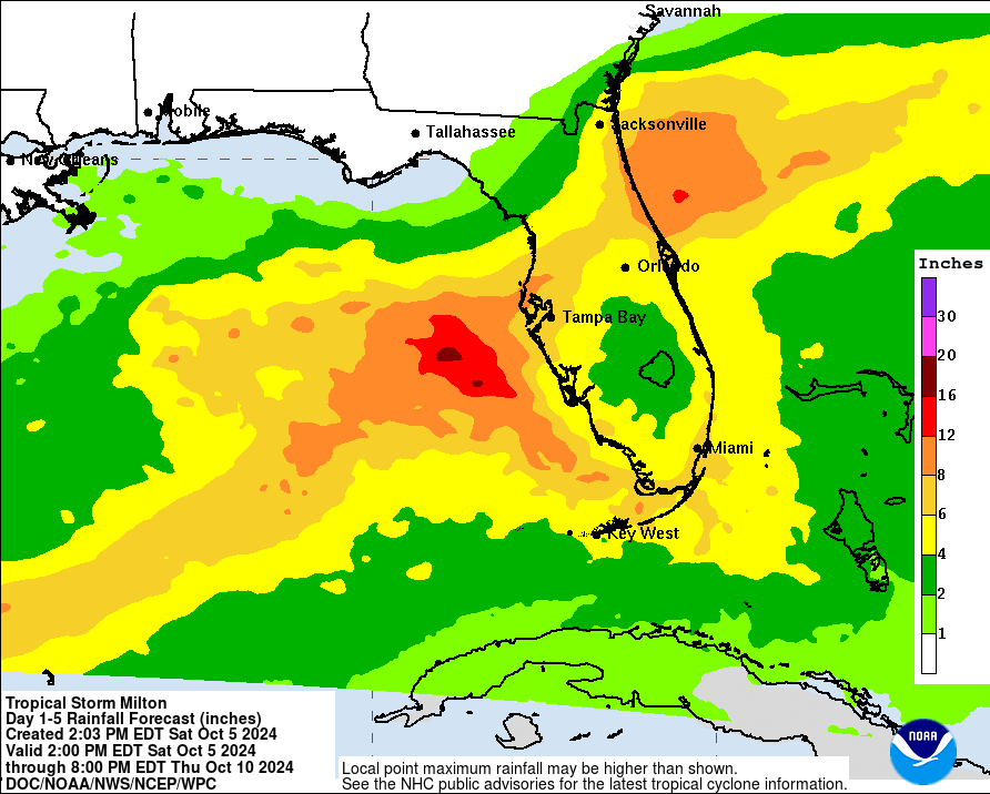
RAINFALL: Rainfall amounts of 5 to 8 inches, with localized totals up to 12 inches, are expected across portions of the Florida Peninsula and the Keys through Wednesday night. This rainfall will bring the risk of flash, urban, and areal flooding, along with minor to moderate river flooding.
The system may also produce rainfall of 2 to 4 inches across portions of the northern Yucatan Peninsula and western Cuba.
SURF: Swells generated by the system will begin to affect the coast of the southwestern Gulf of Mexico today. These swells are expected to spread northward and eastward along much of the Gulf Coast by early next week. These swells are likely to cause life-threatening surf and rip current conditions. Please consult products from your local weather office.
Forecaster Brown


